
Strong as a Chère rock
Talloires-Montmin
Strong as a Chère rock
Easy
0h45
2,4km
+107m
-106m
Embed this item to access it offline
The Roc de Chère is a complex geological structure. Such great biodiversity in such a small area makes the area unique. Sandstone ridges, fissures, nummulites... Find out more about these little-known phenomena.
Attachment
- Downloadpdf
solide-comme-un-roc-de-chere
Credit: Points d'intérêts du parcours - Asters-CEN74
6 points of interest
@MalorieParchet  Geology
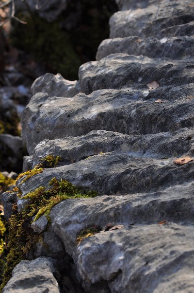
Geological formations: lapies
Lapies are limestone rocks with numerous grooves. Created by water running off the surface, they reveal the presence of an underground karst network. Several other lapies formations are known in the region: the Parmelan plateau, the Platé desert in Passy and the Margeriaz in the Bauges.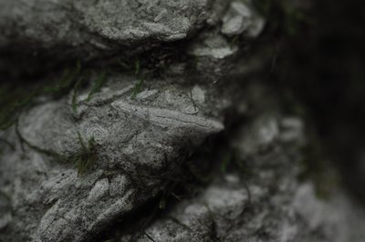
@MalorieParchet GeologyWhere does the limestone come from?
Limestone is a sedimentary rock formed by the build-up of shells and remains of marine wildlife. Remains are being slowly accumulated and transformed into rock by the sheer force of temperature and pressure. Around 130 to 120 million years ago, the Roc de Chère was under the sea. Fossils, the remains of the limestone shells of numerous organisms appeared on the seabed at this time. The soil of the Roc de Chère at that point was made up of limestone from the Urgonian period, rich in fossils. Further on, as shown in the photo, limestone with small nummulites can be seen, indicating that it was formed at different epochs. In everyday life, limestone can be found in many different forms: chalk on blackboards, snail shells, etc.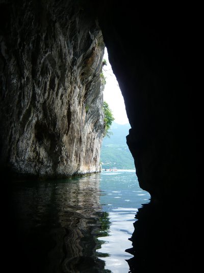
@MalorieParchet GeologySearch for the hidden cave
The karstic massif of the Roc de Chère shape looks just like a big slice of Swiss cheese, due to the breakdown of the rock by the circulating water. As a result, it is riddled with a plethora of caves, most of which are adjacent with the lake. The largest is the Grand Pertuis (see photo), which means "fissure", a narrow passage between the rocks. This cave is only accessible from the lake. Please stay on the trails to respect the biodiversity of this fragile environment.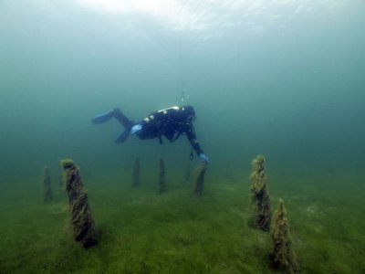

The remains of a civilization
Just opposite the Château de Duingt, you can see the remains of a civilisation dating back to more than 3,000 years BC. Under the waters of Lake Annecy lie ancient palaeolithic sites. Wooden piles are evidence of the existence of ancient dwellings built on stilts below the current level of Lake Annecy / built on the shores of Lake Annecy, which was then lower than it is today. Three such areas have been identified on Lake Annecy (2 in Sévrier and one in St Jorioz). They are among the 111 palaeolithic sites found throughout the Alps and listed as UNESCO World Heritage sites.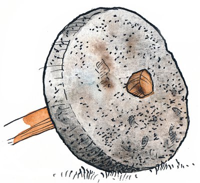

What are these rock marks?
Looking beyond this beautiful view, you will surely have spotted the round marks of ancient millstone extractions in the sandstone slabs. There is also an engraved cross representing the former demarcation line between the territory of the County of Menthon and that of the monks of Talloires Abbey. In the 17th century, some of the stones were removed, probably for use as grinding stones for grapes, wheat, or walnuts and to produce wine, flour, or oil.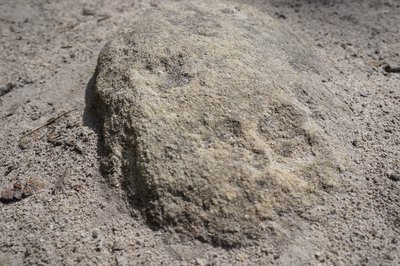
@MalorieParchet GeologySandstone or limestone? How about both?
The Roc de Chère is made up of two main types of rock: limestone and sandstone. Sandstone is a sedimentary rock composed of sand, or more precisely silica. It erodes easily and yields a grey sand that is highly acidic, which you may have seen at the most recent viewpoint. The vegetation that grows on the sandstone has evolved to tolerate such acidity. It bears a striking resemblance to the vegetation of the Fontainebleau forest, which also grows on sandstone. Because sandstone is an impermeable (waterproof) rock, you'll see the Roc de Chère fill up with more than 30 temporary puddles from autumn to spring.
Description
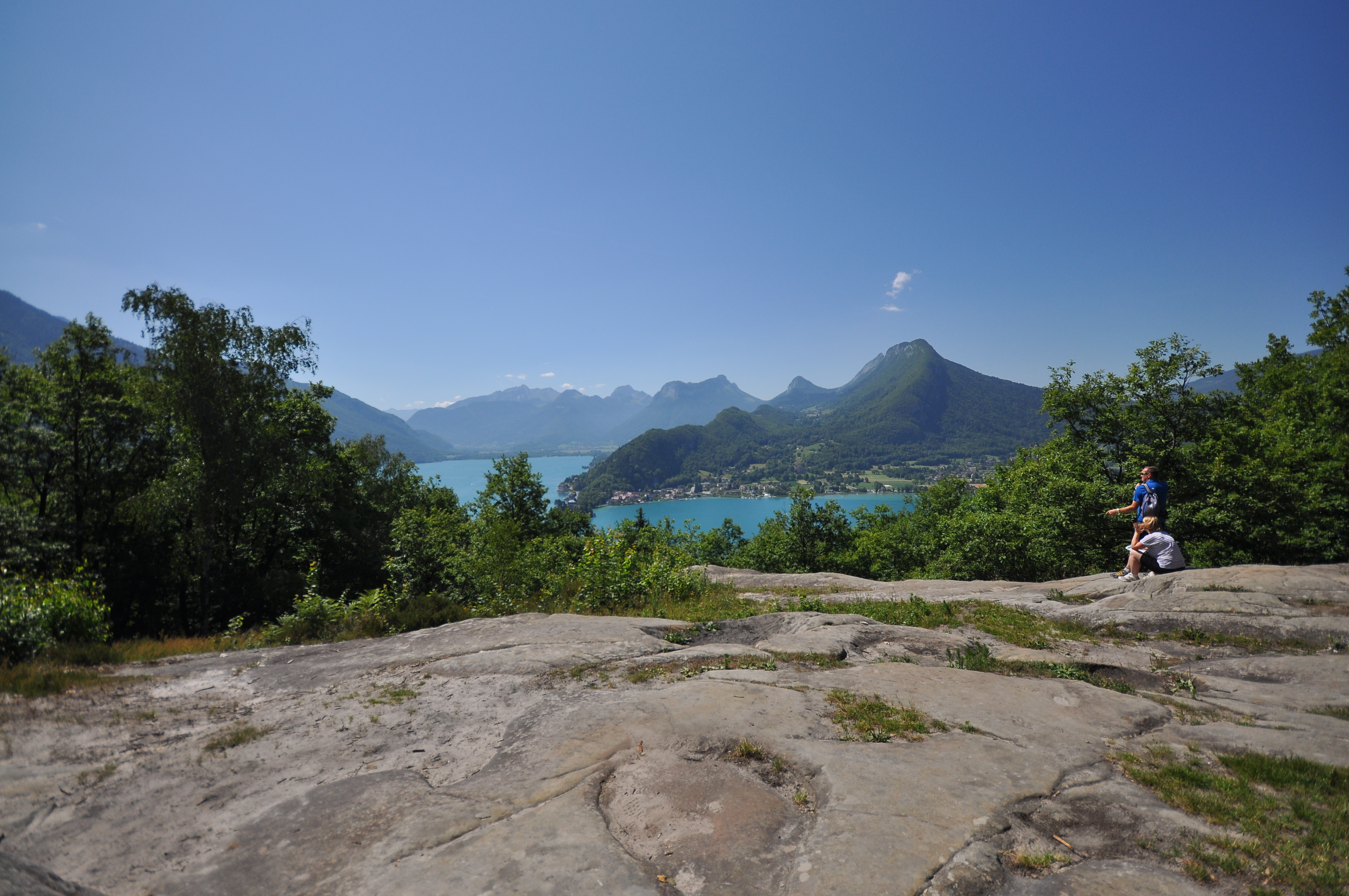
From the car park, follow the signs for "Belvédère de la Crête". Once you reach the viewpoint, a quick round trip (50 m) will take you to the panoramic view of the Petit Lac, La Tournette to the left, the Massif des Bauges to the other side and the beautiful crest of the Montagne d'Entrevernes. Take the path downhill towards "Belvédère du Roc de Chère". Turn right towards "Echarvines par la Patte d'Oie". At the "Patte d'Oie" junction, turn left, then follow the path along the golf course to the right which leads back to the car park.
- Departure : Parking «Le golf d'Echarvines »
- Arrival : Parking Golf d'Echarvines
- Towns crossed : Talloires-Montmin
Altimetric profile
Recommandations
You are in a nature reserve, a protected and fragile environment. By complying with the regulations in place, you can help to reduce disturbance to the natural environment, fauna and flora, and play your part in preserving nature. Always be careful and considerate when out hiking. Asters, CEN 74 cannot be held responsible in the event of any accident or incident that may occur on this trail.
Transport
Bus: 60 Annecy - Angon, Echarvines stop https://annecy.transdev.com/line/ligne-60/ Cycling: "green" cycling route around Lake Annecy
Access and parking
Route du Golf, 74290 Talloires-Montmin Take the road D909a from Annecy towards Talloires. Go through the village of Menthon-Saint-Bernard, at the hamlet of Echarvines (speed bumps on the road) turn right towards the Talloires golf course. After about 200 metres, park on the right in the large gravel parking area. From Doussard, take the road D909a towards Talloires. Drive past Talloires. After sharp twisty turns, at the end of the long straight road, turn left towards the Talloires golf course.
Parking :
Parking Golf d'Echarvines
More information
Report a problem or an error
If you have found an error on this page or if you have noticed any problems during your hike, please report them to us here: