
Reaching Roc de Chère via Talloires : In the footsteps of the past
Talloires-Montmin
Reaching Roc de Chère via Talloires : In the footsteps of the past
Medium
1h30
5,5km
+276m
-276m
Embed this item to access it offline
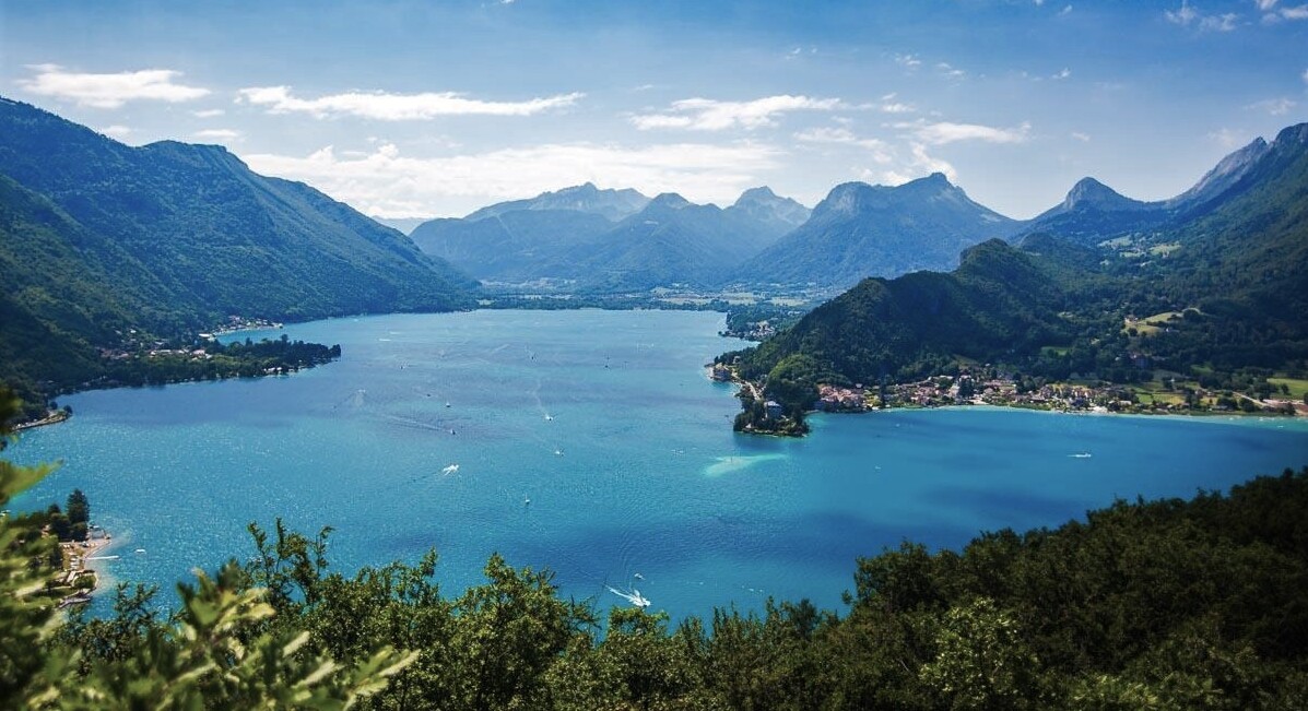
Follow a historic route, built a long time ago by the monks of the Abbey of Talloires to search for wood. This hike offers a nice contemplative break with several viewpoints on the lake of Annecy and the mountains.
Attachment
- Downloadpdf
roc-de-chere-depuis-talloires-sur-les-traces-du-passe
Credit: Points d'intérêts du parcours - Asters-CEN74
7 points of interest

In the footsteps of monks
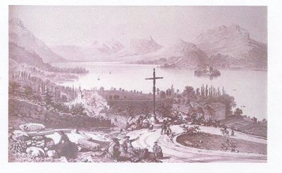
The priory was founded in 1018 and became a royal abbey in 1674. The monks lived in the abbey up until 1793. For a long time, they were the owners of a section of the Roc de Chère, and used the site in a variety of ways: harvesting firewood, grazing livestock, growing crops (wheat, rye, barley, vines), farming fish (with the addition of a fishpond) and extracting materials. The monks' path was restored in late 2012. Back then, the forest was considerably less dense!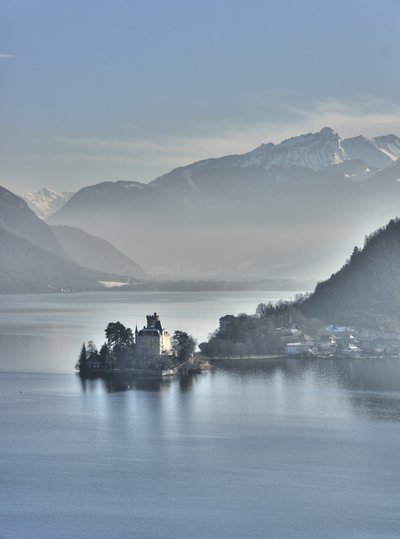
J.Heuret What's that castle over there?
On the other side of the shore is located the peninsula of Duingt, home to castle of Duingt since approximately 1000 years. The castle was formerly called ‘Châteauvieux’. This fortress of medieval origin, property of the lords of Duin, made it possible to control the route of salt trade between Moutiers in the Savoie region and Geneva. Châteauvieux has now become the property of the Certeau family.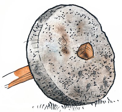
What are these rock marks?
Looking beyond this beautiful view, you will surely have spotted the round marks of ancient millstone extractions in the sandstone slabs. There is also an engraved cross representing the former demarcation line between the territory of the County of Menthon and that of the monks of Talloires Abbey. In the 17th century, some of the stones were removed, probably for use as grinding stones for grapes, wheat, or walnuts and to produce wine, flour, or oil.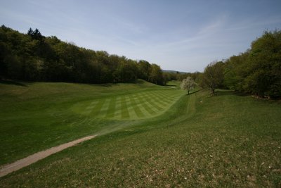
The golf course: a historic partenership
The Golf course at Lake Annecy was created in 1953 on the Roc de Chère site. At that time, the national nature reserve did not yet exist, as it was only created in 1977. Today, the golf course boasts a total of 18 holes, part of which is located in the heart of the nature reserve. An environmental charter sets out objectives for preserving the ecosystems and defines the best practices to be put in place as part of a partnership to ensure biodiversity friendly environment.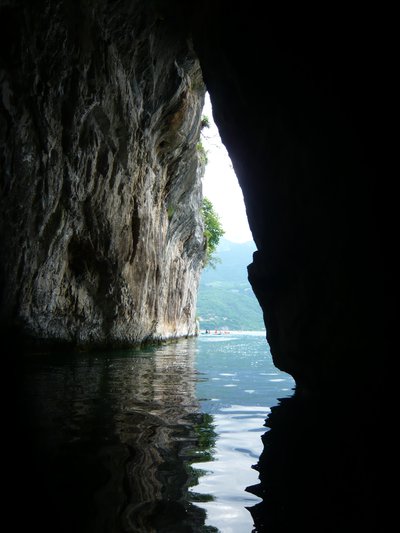
@MalorieParchet  Geology
Search for the hidden cave
The karstic massif of the Roc de Chère shape looks just like a big slice of Swiss cheese, due to the breakdown of the rock by the circulating water. As a result, it is riddled with a plethora of caves, most of which are adjacent with the lake. The largest is the Grand Pertuis (see photo), which means "fissure", a narrow passage between the rocks. This cave is only accessible from the lake. Please stay on the trails to respect the biodiversity of this fragile environment.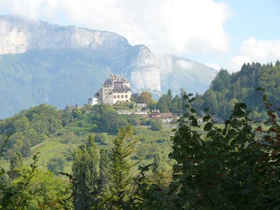
Menthon-Saint-Bernard castle
In the 12th century, the Menthon-Saint-Bernard castle served as a stronghold where villagers could seek refuge during turbulent times. It was only after the Renaissance that the austere castle was transformed into a residential estate. Today, it is a rich manor house that has belonged to the same family for 23 generations.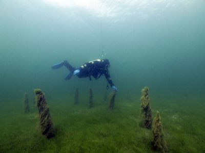

The remains of a civilization
Just opposite the Château de Duingt, you can see the remains of a civilisation dating back to more than 3,000 years BC. Under the waters of Lake Annecy lie ancient palaeolithic sites. Wooden piles are evidence of the existence of ancient dwellings built on stilts below the current level of Lake Annecy / built on the shores of Lake Annecy, which was then lower than it is today. Three such areas have been identified on Lake Annecy (2 in Sévrier and one in St Jorioz). They are among the 111 palaeolithic sites found throughout the Alps and listed as UNESCO World Heritage sites.
Description
From the car park, head towards Talloires Abbey. Walk along the shoreline via the narrow passageway on the edge of the lake. You will come to a nature reserve information panel. Now take the path on the right that climbs up the wooden steps. The beginning is quite steep. At the "Sous le belvédère" sign, turn right towards the "Belvédère du Roc de Chère". The path climbs uphill, so watch out for the path marked with a cross. After admiring the view of the Bauges and the lake, turn left towards "la patte d'oie" and continue straight on towards "Talloires par les Granges". Following the markers, go along the golf course on your right and you'll soon come to the "Granges d'Echarvines" sign. Take the path on your right which climbs slightly towards the "Belvédère de la Crête". On the way up, after about 10 minutes, don't miss the first viewpoint on the right (marker). This is the only place from which you can see the entire Roc de Chère massif. Panoramic views of Lake Annecy, Le Semnoz on the opposite side, Mont Veyrier and Le Parmelan on the right will complement the views from the other viewpoints further on. Continue uphill and once you've reached a flatter area, you'll come to the "Belvédère de la Crête". A quick round trip (50 m) will take you to the panoramic view of the small lake, La Tournette to the left and the Bauges massif opposite. Take the path downhill towards "Belvédère du Roc de Chère". Retrace your steps and descend to the left as far as the sign for "Sous le belvédère". Turn left towards "Baie de Talloires" on a steep descent.
- Departure : Public parking lot of Talloires
- Arrival : Talloires public parking
- Towns crossed : Talloires-Montmin
Altimetric profile
Recommandations
Hikes require sturdy hiking footwear. The first slope is steep and can be difficult for novice hikers on both the initial and return journeys. Alternative route from Echarvines: follow the Comballe path. You are in a nature reserve, so please respect its fragile nature. Always exercise caution and plan ahead when hiking. Asters, CEN 74 cannot be held responsible for any accident or incident that may occur on this trail.
Transport
Bus No. 60 Transdev Along the cycling route around the lake.
Access and parking
From Annecy, take the road D909a through the village of Talloires along the eastern shore of the lake. Park in the public car park (for which there is a fee in summer) just outside the village centre. From Faverges: take the road RD 1508 to the Doussard roundabout. At the roundabout, follow signs for Talloires.
Parking :
Talloires public parking
More information
Report a problem or an error
If you have found an error on this page or if you have noticed any problems during your hike, please report them to us here: