
Morillon Les Esserts: Plateau de la Charniaz
Morillon
Morillon Les Esserts: Plateau de la Charniaz
Easy
1h30
3,5km
+118m
-118m
Embed this item to access it offline
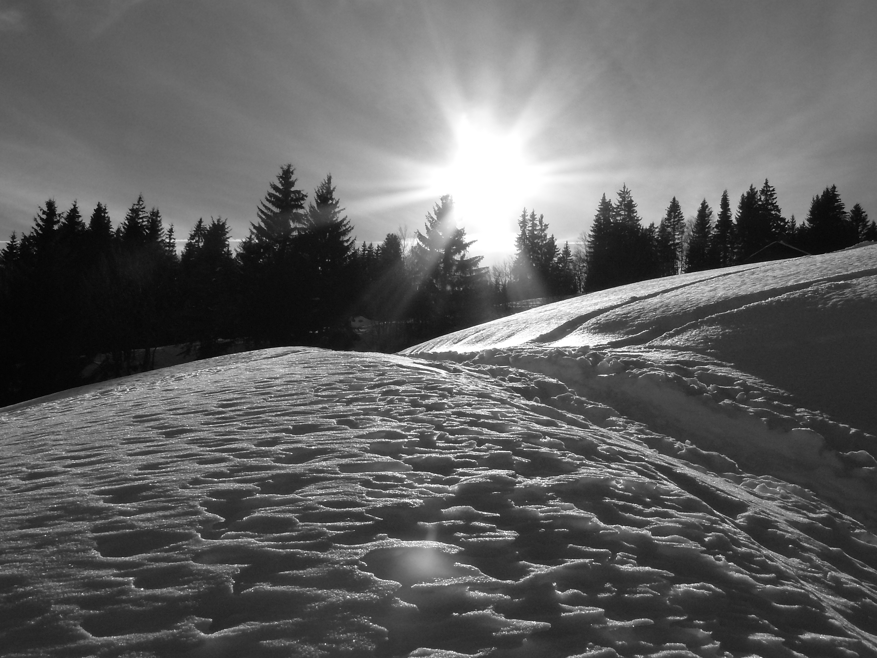
Passing through woodland, the trail winds its way between several streams for a pleasant, easy walk (with almost no changes in elevation) with views over the entire valley.
Attachment
- Downloadpdf
morillon-les-esserts-plateau-de-la-charniaz
Credit: Points d'intérêts du parcours - Asters-CEN74
4 points of interest

LorraineSuty  Fauna
FaunaKeeping quiet in the mountains
In the heart of this fragile natural environment, noise can be a nuisance to both wildlife and other visitors. People come here to rest and recuperate, to listen to the whistle of marmots, the call of a bird of prey or the trickle of a stream. Excessive noise can have harmful consequences for the reproduction and survival of wild animals, so it's important to minimise noise disturbance. It's our "playground", but it’s their home so let's adopt the right attitude!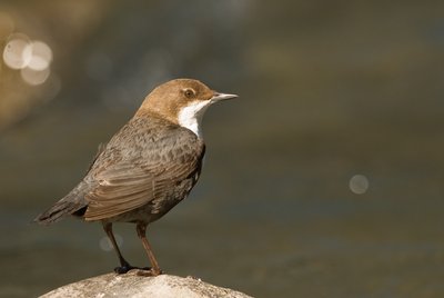
@FrankMiramand FaunaThe white-throated dipper
The white-throated dipper is a small aquatic bird. It has dark brown plumage and a white chest. Its special feature is its ability to dive and swim underwater with its short, rounded wings to obtain food. The dipper nests in rocky crevices along watercourses. The presence of dogs (not kept on a leash) in its environment can be fatal for its chicks. If you listen carefully, you may be lucky enough to hear its melodious song!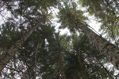
@julietteBuret  Flora
FloraSpruce forest
This predominantly coniferous forest (fir, spruce, pine and larch) is a key ecosystem in the Alpine landscape. Whether natural or artificially planted, spruce forests have two main functions: to protect soils from erosion and to produce wood. These forests are often threatened by human activities such as logging, agriculture and urban development. These threats generally lead to difficulties in regeneration, to mineralisation of the soil and loss of the microclimatic environment in the undergrowth. Stay on the existing trails to avoid creating new ones!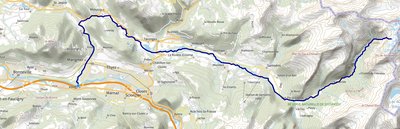
 Lake
LakeA mountain stream, or a nant
A nant is a term used to describe a mountain stream. This environment is very difficult for aquatic life. Here you will cross a maze of watercourses ( the Perrière stream, the Cuttaz brook and, further on, the Nant Taffon) that feeds the Giffre, a tributary of the Arve and a sub-tributary of the Rhône. The Giffre originates in the Sixt-Fer-à-cheval nature reserve.
Description
From the Morillon 1100, the trail starts in front of the parking lot in Les Esserts village. Once you reach the Charniaz plateau, take the path to the forest edge on your right. The trail marked with “Domaine du Haut Giffre” signposts, crosses a forest and several streams. Back in a glade, go slightly uphill towards the Chalet de la Charniaz. On the plateau, you can see the Pic du Marcelly to the West and the Aouille du Criou to the East, two iconic peaks of the valley. To return, you can find the trail back on your left, where you'll take the initial path to go back to the parking area.
- Departure : Morillon les Esserts
- Arrival : Morillon les Esserts
- Towns crossed : Morillon
Altimetric profile
Recommandations
Warning: The trail conditions are subject to change, remember to inquire before leaving!! Always be careful and plan ahead when hiking. Asters, CEN 74 can not be held responsible for the occurrence of any accident or incident on this itinerary!!! Access to the trail is subject to weather conditions. For more information, contact the Tourist Office: Haut-Giffre Tourisme : 04 50 34 49 36 https://www.haut-giffre.fr/je-decouvre/nos-territoires/morillon/
Transport
From Morillon village : Essert cable car. https://www.grand-massif.com/info-live-ete/ Free bus shuttles stop at several ski resorts : https://www.grand-massif.com/navette-skibus/
Access and parking
Located on the D54 road at the entry to Les Esserts village, it is only a 10 minute drive from Morillon Village.
Parking :
Morillon 1100 parking area, Les Esserts
Report a problem or an error
If you have found an error on this page or if you have noticed any problems during your hike, please report them to us here: