The Grand Bois loop at Rivière-Enverse
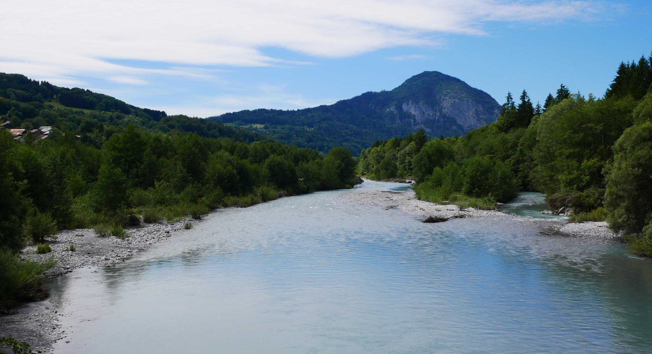
La Rivière-Enverse
The Grand Bois loop at Rivière-Enverse
Easy
1h30
6km
+154m
-154m
Embed this item to access it offline
From otters to the impacts of pebble dams on watercourses, this trail provides a wealth of information on the aquatic ecosystem.
Attachment
- Downloadpdf
boucle-de-grand-bois-a-la-riviere-enverse
Credit: Points d'intérêts du parcours - Asters-CEN74
4 points of interest
 Lake
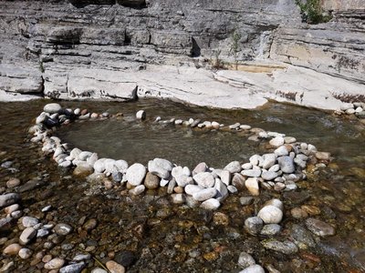
LakeNegative impact of artificial dams on rivers
Occasionally, hikers and families may build a temporary dam just for fun. By creating artificial dams, they slow down the natural flow of the river and cause harmful effects: - The movement of aquatic species is essential to enable them to feed and reproduce. - The temperature of the water rises, silt and algae thrive and it becomes more difficult for fish to breathe. - Stones are refuges and habitats for many of the micro-organisms that feed fish. Moving or turning stones upside down endangers the aquatic environment. To protect the river, we must let it flow freely.
 Flora
FloraRiparian forest
The riparian forest is a group of wooded areas (trees, shrubs and bushes) found along the banks of a watercourse. The riparian zone has many benefits for the ecology of the watercourse: - Combats erosion: rooted trees help maintain riverbanks. - Filters pollutants: fertilisers and pesticides can be absorbed by plants and soil-dwelling micro-organisms, limiting their presence in watercourses. - Shading: riparian vegetation provides shade, reducing warming, evaporation, eutrophication and additional oxygen. - Dissipates water flow: riparian vegetation slows the flow of water during floods, reducing the risk of flooding. - Shelter and food: the riparian forest is a source of food, a breeding ground, a refuge and a place to live for numerous animal and plant species, both terrestrial and aquatic.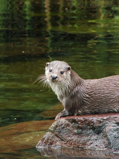
@FrançoisPanchaud  Fauna
FaunaThe Otter
Having disappeared from a large portion of France, the Eurasian otter is now in the process of recolonising certain territories, albeit quite slowly due to a low reproduction rate. Now classified as a "protected species", the otter is suffering the consequences of certain human activities that are hampering its population growth, such as river pollution, development of road networks and land fragmentation. This discreet and rare species can be distinguished from nutria or other semi-aquatic animals by : - Its swimming technique: the otter's back and head stay out of the water - Its tail is broad and thick - It is carnivorous, eating fish and small amphibians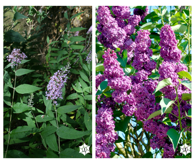
buddleias-vs-lilas  Flora
FloraInvasive non-native plants
Solidago, butterfly bush, Japanese knotweed, Himalayan balsam, all these garden escapees are causing problems today because they are displacing our wild plants. These are aggressive plants that compete with other species, upsetting the local ecological balance. The Conservatoire d'espaces naturels de Haute-Savoie, which manages the nature reserve, regularly calls on volunteers to uproot these invasive plants in order to preserve the local vegetation.
Description
From the Rivière-Enverse church, turn right onto Rue des écoles in "Nicodex" direction. Take the narrow path starts between houses (please follow the signs) which leads to a wider gravel path. At the Nicodex chapel, keep right, then go straight on towards "Fargot d'en Haut", crossing a river and the well-known "Grand Bois". Go down again by the road on your right, towards the Cellières hamlet. Then, the trail leaves the road and join it back as far as Cellières (watch out for the signs), winding its way between houses. At the Cellières hamlet, turn right towards the chapel and "Fargot". Continue straight ahead on the wide road down to the RD4. Cross the RD4 to reach the Giffre river, and keep to the right as you pass the forest edge. Follow The Giffre on your right passing the gravel pit. After the refreshing woodland and the Giffre, turn right (Clos Long country road) towards Rivière-Enverse. To return to the village, take a few metres up the RD4 to the right, then turn left straight away to reach the road and then the church
- Departure : Mairie (Town Hall) of Rivière-Enverse
- Arrival : Mairie (Town Hall) of la Rivière-Enverse
- Towns crossed : La Rivière-Enverse
Altimetric profile
Recommandations
Always be careful and plan ahead when hiking. Asters, CEN 74 can not be held responsible for the occurrence of any accident or incident on this trail.
Access and parking
In the centre of the Rivière-Enverse village.
Report a problem or an error
If you have found an error on this page or if you have noticed any problems during your hike, please report them to us here:
