
Combe noire Waterfall
Les Contamines-Montjoie
Combe noire Waterfall
Easy
3h
5,3km
+314m
-314m
Embed this item to access it offline
Following the path of water and history, this forest itinerary will plunge you into the atmosphere of a mountain forest filled with the freshness of the stream's turbulent waters. The walk concludes with a breathtaking view of the Combe Noire waterfall.
7 points of interest
La voie romaine - Geoffrey Garcel - CEN 74 
The Roman roads
More than just a tourist attraction, the Roman roads were one of the main routes used to cross the Alps in ancient times! Before the Roman invasion, the Ceutrones, a Celtic tribe who farmed livestock, inhabited the Val-Montjoie. To make cheese, they used salt mined at Moutiers via the Col du Bonhomme. They were involved in building roads to Italy. These roads were taken over by the Romans when they invaded the Alps. Take a look at the Rochassets pass: it was carved out of the rock to allow chariots to pass through!
Tourbières de la Rosière - Geoffrey Garcel - CEN 74  Flora
FloraRosière boglands
On your left are the Rosière boglands, but be careful to only admire them while walking along the path, as they are fragile environments and hidden treasures of biodiversity! Tracing its origins from the Ice Age, this boggy area is the result of a glacier erosion which caused water to stagnate. This is the kingdom of carnivorous plants such as the Alpine cattail or the round-leaved sundew...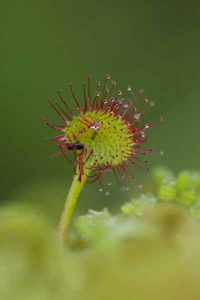
Insecte pris au piège d'une Drosera - Geoffrey Garcel - CEN 74 FloraThe round-leaf Sundew
It is a small carnivorous plant that lives in low-nutrient peat bogs. Don't worry, it only feeds on insects, which it attracts and digests using a viscous substance produced by the red bristles that cover its leaves. It is also known as " Rossolis or Sundew " because the substance sparkles when exposed to light. This species is fragile and protected, please do not touch it!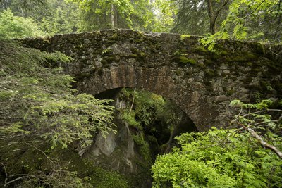
Pont romain - Geoffrey Garcel - CEN 74  Small patrimony
The Roman bridge
Also known as the "Téna Bridge", this structure dates back to Roman times! It is located on the strategic route used at that time to reach the Tarentaise valley and Italy from Les Contamines. This route, which has since become the famous long-distance GR5 hiking trail, is a popular tourist attraction. The bridge overlooks the gorges of Bont nant. Marvel at the pools of water that the waterstream has sculpted over the years!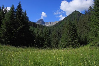
Panorama prairie La Laya - Geoffrey Garcel - CEN 74 
Hay meadows of la Laya
Formerly mown and grazed, these meadows have slowly turned into woods since the abandonment of all pastoral activity. Shrubs and spruce have gradually colonised these former meadows. This is known as the closure of the environment, endangering certain plants such as the Golden Oat, a favourite snack of the livestock, and the Alpine Colchicum. Since 2014, the Nature Reserve has been clearing the undergrowth and mowing the meadows regularly in order to restore their function as summertime pastures.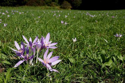
Colchique des Alpes - Julien Heuret - CEN 74 FloraThe Alpine Autumn Crocus
It's the end of summer... This is the time of year when the Alpine Autumn Crocus blossoms. Its name comes from Colchis in Greece, home to infamous poisoner Medea. This plant contains a highly toxic alkaloid: colchicine. According to the alchemists, this substance, when used in very small doses, could be used to treat rheumatism and episodes of gout.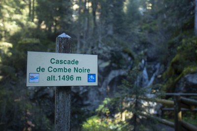
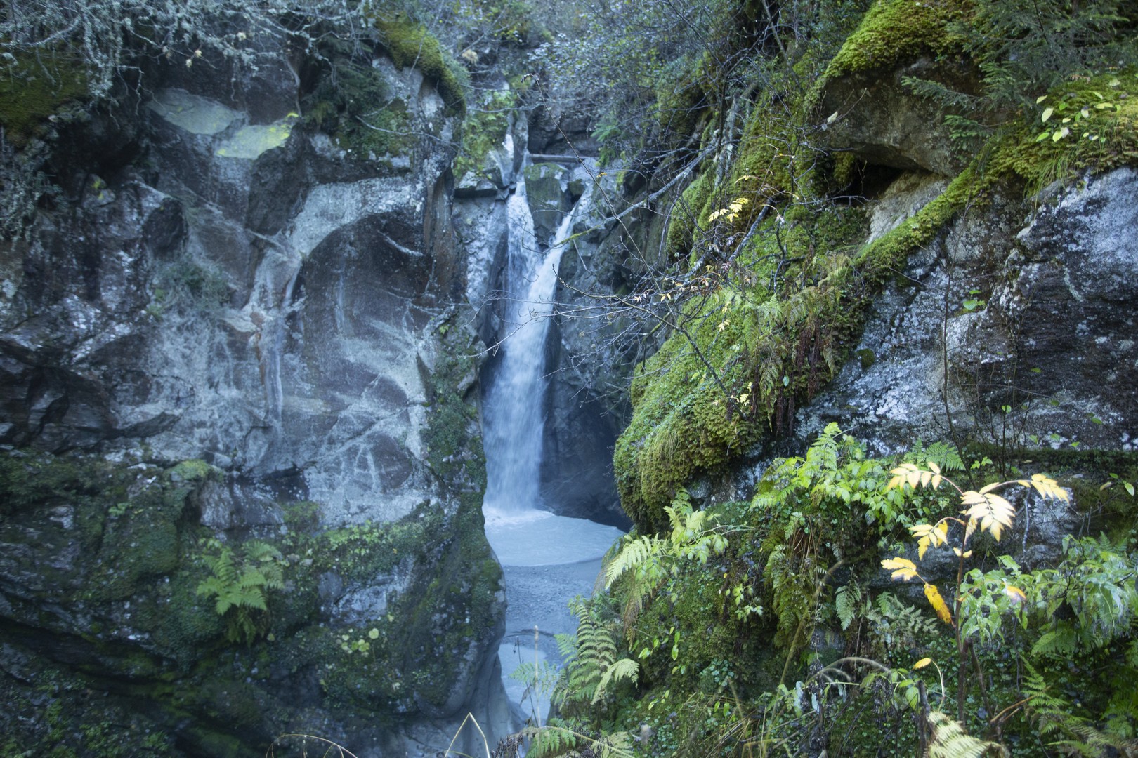
Cascade de Combe noire - Geoffrey Garcel - CEN 74  Geology
Combe noire waterfall
When you stop at this bridge, you can feel the fresh spray from the Combe Noire waterfall and just imagine that the Tré-la-Tête glacier arrived here in 1870! Since then, the glacier has melted a few hundred metres, but its presence can still be felt through the raging river, which has formed impressive sculptures known as "potholes of giants" as it erodes the rock in a thunderous racket!
Description
Start at the Notre-Dame de la Gorge car park in Les Contamines-Montjoie: Cross the footbridge opposite the stream to join the itinerary. Stay on the main route up the stream. Stay on the Grande Route and take the Roman road that stretches out in front of you. Stay on the route and cross the Roman bridge. Turn left towards "la Laya" - "Tré la tête". Turn left to reach the Combe Noire waterfall. You've arrived. You can return by the same route.
- Departure : Parking « Notre Dame de la Gorge », Les Contamines-Montjoie
- Arrival : Parking Notre Dame de la Gorge, les Contamines Montjoie
- Towns crossed : Les Contamines-Montjoie
Altimetric profile
Sensitive areas
Along your trek, you will go through sensitive areas related to the presence of a specific species or environment. In these areas, an appropriate behaviour allows to contribute to their preservation. For detailed information, specific forms are accessible for each area.
- Impacted practices:
- Aerial, , Land, Vertical
- Contact:
- Asters - Conservatoire d'espaces naturels de Haute-Savoie
contact@cen-haute-savoie.org
Black grouse - winter
- Impacted practices:
- , Land
- Sensitivity periods:
- JanFebMarAprDec
- Contact:
Recommandations
Always exercise caution and plan ahead when hiking. Asters, CEN 74 cannot be held responsible for any accident or incident that may occur on this trail.
Transport
Bus shuttles depart from the village centre of Les Contamines-Montjoie (from late June to early September).
Access and parking
Reach Les Contamines-Montjoie (74170). Drive through the village and stay on the Route de Notre-Dame de la Gorge (D902) for 2 kilometres until the road ends at the large Notre-Dame de la Gorge car park on your right.
Parking :
Parking Notre Dame de la Gorge
Report a problem or an error
If you have found an error on this page or if you have noticed any problems during your hike, please report them to us here: