
Chalets de Sales: a historical moutain pasture
Sixt-Fer-à-Cheval
Chalets de Sales: a historical moutain pasture
Medium
4h
11,4km
+768m
-768m
Embed this item to access it offline
This site, as beautiful as it is rich in history, has been the subject of a of a Joint Research Programme initiated by the Haute-Savoie Departmental Council. Based on an interdisciplinary approach, this research has enabled us to learn more about the history of human settlement in the mountains. We invite you to take part in these discoveries along this itinerary.
Attachment
- Downloadpdf
chalets-de-sales-un-alpage-historique
Credit: Points d'intérêts du parcours - Asters-CEN74
9 points of interest
L'influence de l'Homme sur les paysages - Francesca Jeanparis - CEN74  Flora
FloraHuman impact on landscape
This forest is the landscape that would have covered almost the entire valley if humans had never settled in the high Alpine vales. The landscapes you will come across along this route may seem untouched and wild, but they are largely the result of human actions undertaken in the mountain environment. To understand and explain them, you need to take various fields of study into account, following the example of the Joint Research Programme that shed light on the past of the Sales mountain pastures.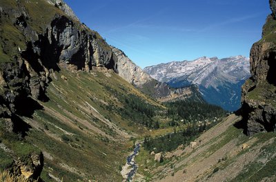

Dynamic landscape
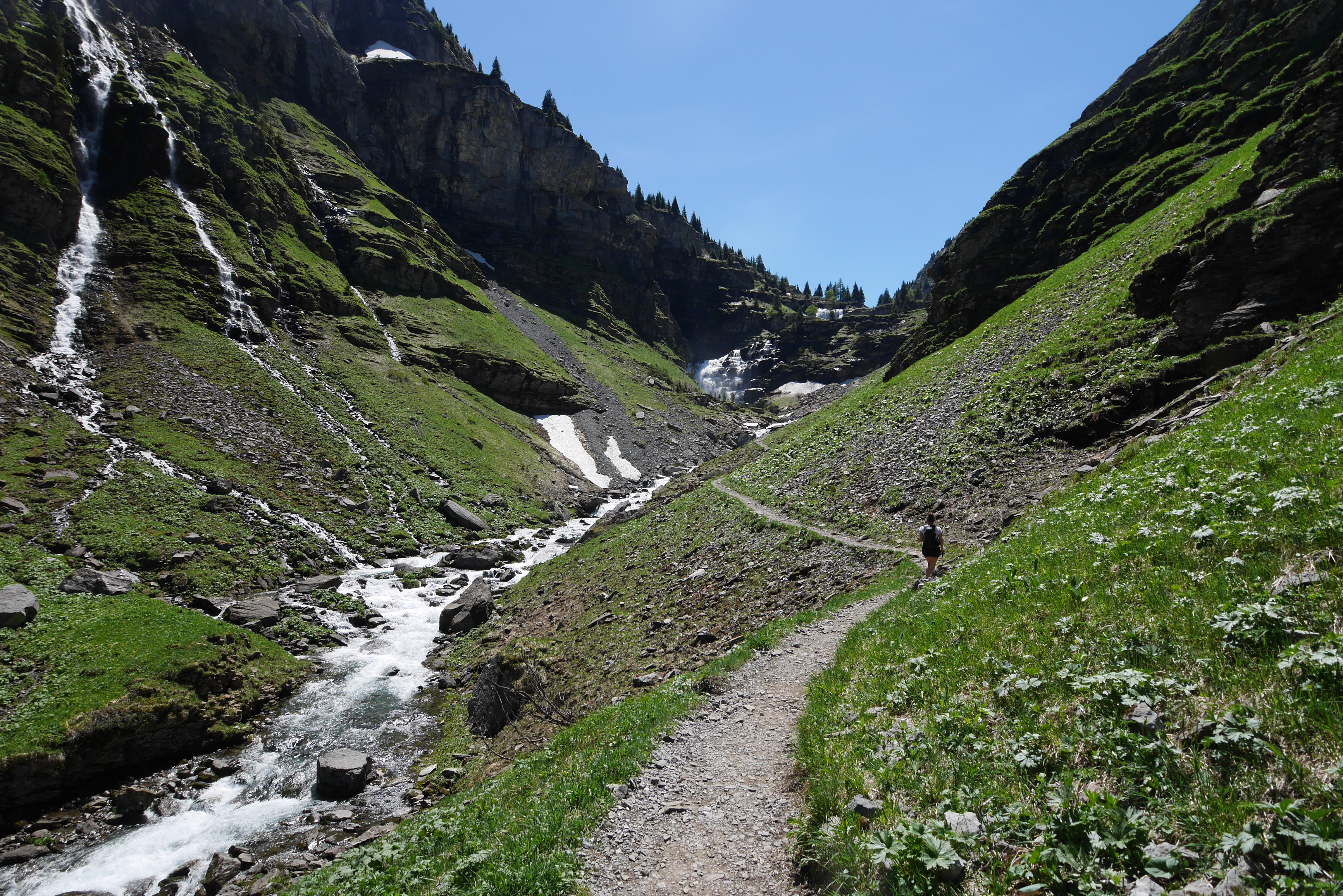
Landscapes can change over time, depending on a variety of conditions. Le Clos de Sales, the vast flat area you have just entered, is a prime example of such change. Le Clos, which was under the ice for a long time, subsequently became the home of plant species that are very different from those we see today (birch, cembro pine, etc.). One geomorphologist, who has studied the geological environment in order to better understand the conditions under which flora, fauna and humans first showed up, speculate that there may have been a lake after the ice melted. As for the surrounding relief, it was worn away, leaving the marks of its slow erosion over time on its slopes. Eventually, the humans arrived and in a true human fashion, cut down the forests in order to make land for grassy areas. This, however, did not last, as the forest retook what belonged to it and is now reclaiming the land.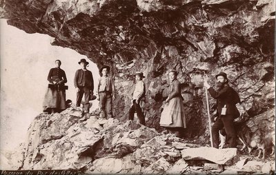
Pas d'alpage de Sales sans le Pas de Sales ! - Conseil Départemental 74 
Pas de Sales pasture grounds
When the snow melted and the grass began to grow at higher altitudes, some of the villagers took their livestock up to the mountain pastures for the summer. In the past though, without human intervention, access to the Sales mountain pasture was much less straightforward than via this route. Carved out of rock in the 19th century using primitive methods, it's easy to imagine the colossal efforts and risks involved in building this route to facilitate access to the mountain pastures.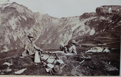
Vivre sur les pentes - Conseil Départemental 74 Life on the slopes
From this flat area, where the Sales torrent rises to the surface, you can see many grassy slopes on the hillsides. Inaccessible to livestock, the locals used to mow the grass to store it locally or bring it down to the valley. There had to be enough reserves to feed the animals in winter, a season that lasted a good 6 months in the mountains! The grass was such a precious resource that every risk was taken to ensure that every plot of grass was harvested.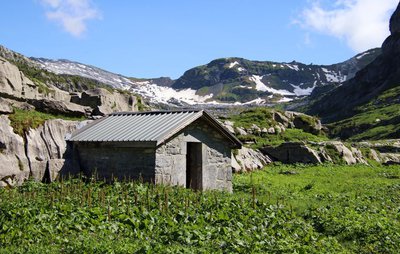
Coup de pouce religieux - Francesca Jeanparis - CEN74 Helping hand of religion
Avalanches and rockfalls can snuff out your life in a matter of seconds, so it's a good idea to try and stack the odds in your favour. Faith was important at the time, which explains the effort made to build a chapel here at 1800 metres altitude. It also represents the link between this mountain pasture and the Abbey of Sixt-Fer-à-Cheval. The presence of the chapel has made it possible to study numerous archives to better understand the history and social organisation of the valley.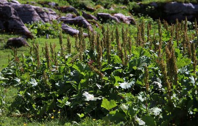
Indice végétal - Francesca Jeanparis - CEN74 FloraMunk's Rhubarb or Alpine Dock
With its large leaves and clusters of flowers, the Alpine dock cannot be missed. This plant is evidence of the presence of livestock, as it proliferates in nitrogen-rich soils (animal manure enriches the soil with nitrogen). Plants and animal remains are excellent indicators that complement other scientific disciplines when it comes to understanding the history of a place, particularly when it comes to identifying areas suitable for archaeological excavation.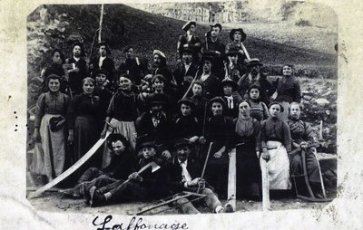
Aux montagnardes - Conseil Départemental 74 To the women of the mountains
It's the inalpe (local alpine festival)! As the men worked in the valleys to make hay, the women and children went up to the mountain pastures alongside their animals to enjoy the beautiful high grass pastures. Hard work pretty much defined their lives: milking the cows, making the cheese, looking after the animals... If you could go back in time, you'd be amazed at the vibrant atmosphere that reigned at this traditional festival!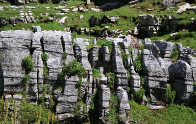
Des contraintes sous la surface - Francesca Jeanparis - CEN74 Lapies: indicator rocks
Lapies are limestone rocks with distinctive grooves. Created by water running off the surface, they indicate the presence of an underground karstic network. This highly efficient natural drainage system dries out the massif at the surface. Water was a vital and precious resource for the people and animals who lived here. A monumental construction at the time made it possible to optimise the use of water: a large rough stone basin which is still being used to this day.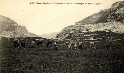
Passage commercial d'altitude - Conseil Départemental 74 A mountain pass or a center of trade?
How about a last push of 3 km and 280 metres of ascent for a beautiful scenic view of the Mont Blanc massif? At the time, the Col de Portette, then the Passage du Dérochoir following the landslide of 1751, were frequently used to trade alpine produce (cheese, quartz crystals, donkeys, horses) with the inhabitants of the Arve Valley and the European trade routes. This means that Sixt-Fer-à-Cheval has never been isolated from the rest of the world!
Description
From Le Lignon, head up the forest track towards Chalets de Sales. After the Cascade de la Pleureuse, continue straight ahead on the path towards the Chalets de Sales. When you reach a flat area, follow the trail straight ahead. At Chalets de Sales, continue on the main path through the village towards "le Grand Pré". When you reach "Grand Pré", take the same route back.
- Departure : Parking « le Lignon »
- Arrival : Parking le Lignon
- Towns crossed : Sixt-Fer-à-Cheval
Altimetric profile
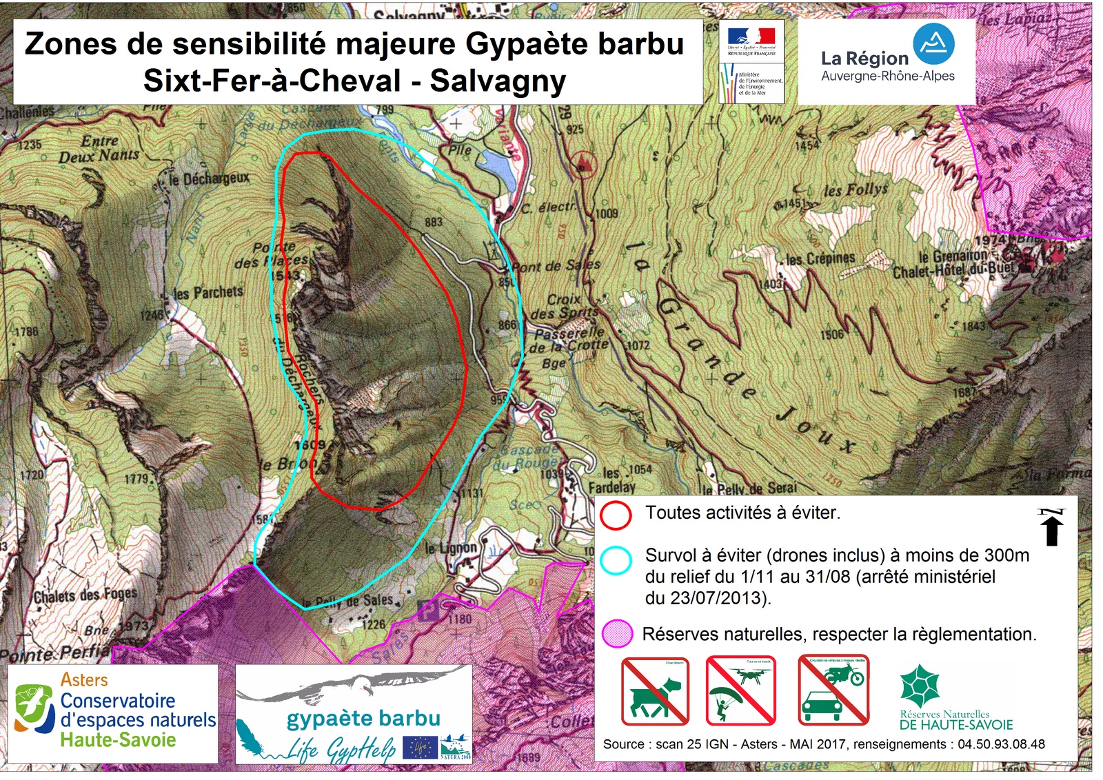
Sensitive areas
Along your trek, you will go through sensitive areas related to the presence of a specific species or environment. In these areas, an appropriate behaviour allows to contribute to their preservation. For detailed information, specific forms are accessible for each area.
- Impacted practices:
- Aerial, , Land, Vertical
- Contact:
- Asters - Conservatoire d'espaces naturels de Haute Savoie
contact@cen-haute-savoie.org
- Impacted practices:
- Aerial
- Sensitivity periods:
- JanFebMarAprMayJunJulAugNovDec
- Contact:
- ASTERS - CEN 74 : 06 49 99 99 48
Bearded vulture
- Impacted practices:
- Aerial, , Vertical
- Sensitivity periods:
- JanFebMarAprMayJunJulAugNovDec
- Contact:
- ASTERS - CEN 74 : 06 49 99 99 48
Recommandations
Always exercise caution and plan ahead when hiking. Asters, CEN 74 cannot be held responsible for any accident or incident that may occur on this trail. The area is accessible from late spring to autumn. Significant snow cover and avalanche risk in winter. Steep, exposed snowcaps until late spring. Herds are protected by patous (Pyrenean Mountain Dog), so please be careful.
Access and parking
Head for the village of Sixt-Fer-à-Cheval. In the village, cross the bridge to the right and follow the "Cascade du Rouget" sign. Follow the road up to the Lignon car park.
Parking :
Parking le Lignon
More information
Report a problem or an error
If you have found an error on this page or if you have noticed any problems during your hike, please report them to us here: