Chalets de Doran: the wings of the bearded vulture
Sallanches
Chalets de Doran: the wings of the bearded vulture
Medium
4h
7,9km
+722m
-720m
Embed this item to access it offline
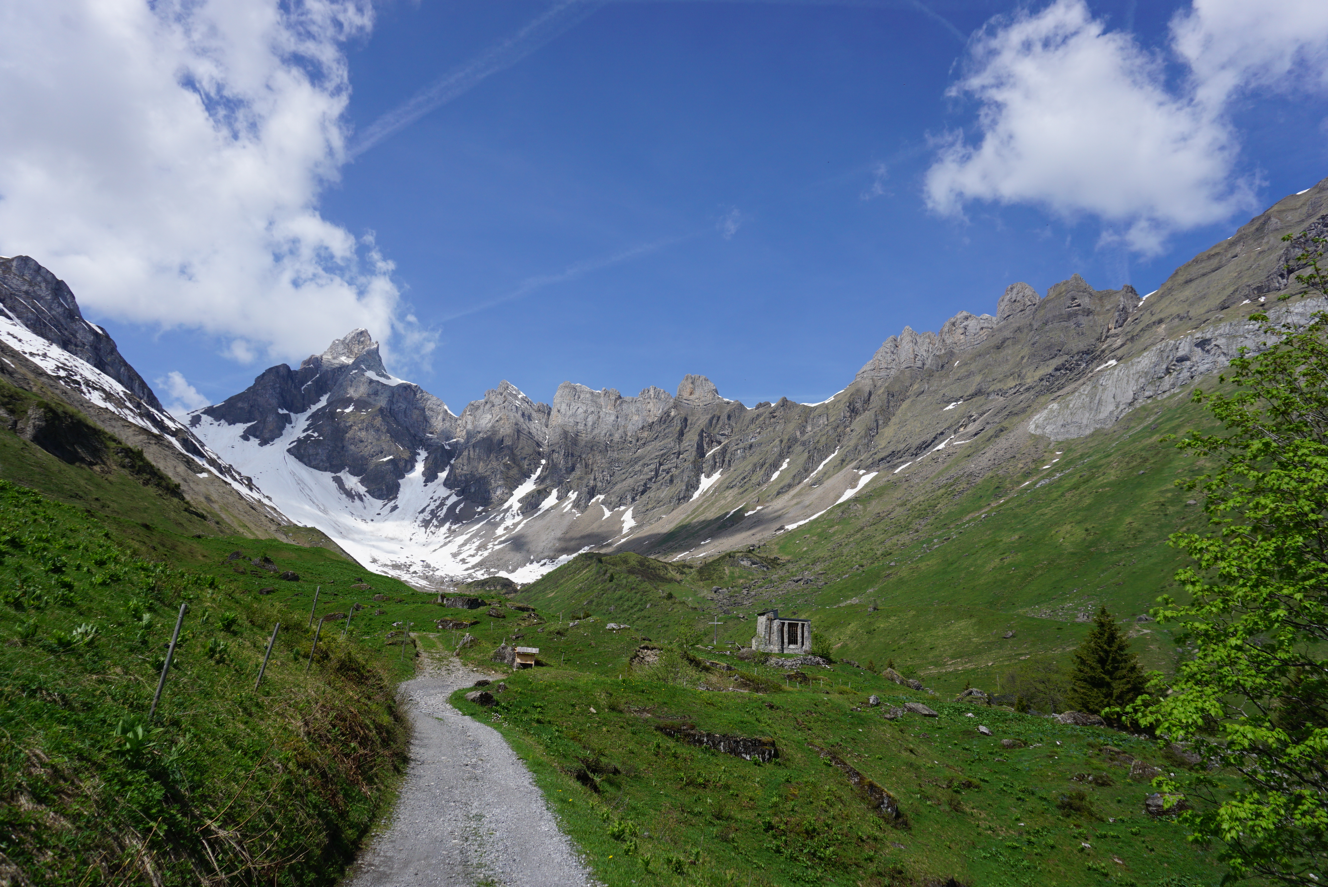
Nestling in the heart of an impressive cirque of mountains, overlooked by the Pointe Percée, the Doran mountain pasture is perfect for observing Bearded Vultures without disturbing them, and learning more about the geology of the Aravis range!
6 points of interest
@JulienHeuret  Fauna
FaunaBird nesting at the Pierre à Voix
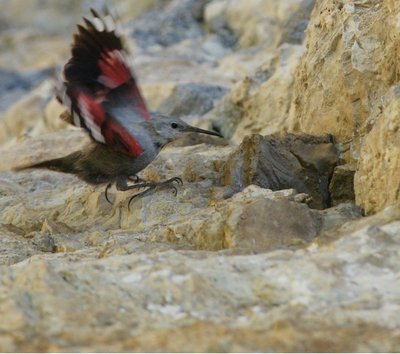
The Pierre à Voix (Echoing stone) is a natural limestone monolith that can be seen rising above the forest from Sallanches. But don’t be mistaken, its name has nothing to do with echo but actually comes from an old local dialect. It is also a very popular spot for mountaineers (between 25 and 50 available trails, graded from 4c to 7b). Wallcreepers have been observed to nestle in the area. This small mountain bird, dubbed the "butterfly bird", builds its nest in the shady, damp crevices in May, and the chicks remain in the nest until the end of June.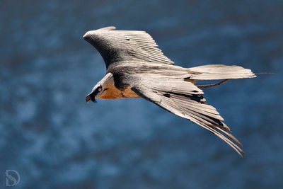
@sophieDunajev  Fauna
FaunaThe Bearded Vulture
A scavenger of the bird of prey family, the Bearded Vulture has been protected and has been reintroduced into Alpine habitats since the 1990s, particularly in Doran from 2001 to 2005: 10 young Bearded Vultures were reintroduced over the course of 5 years (2 per year). The Bearded Vulture has an impressive wingspan, almost 3 metres from one wingtip to the other! It is one of the largest birds of prey in Europe. In flight, the adults can be distinguished by the contrasting plumage: grey slate on the wings, white to orange on the head and belly. The young will only breed from the age of 8 and will only give birth to one chick each year. Hikers can take part in the monitoring of the species by sending us their sightings of this bird: //www.gypaete-barbu.com/3/observez-et-protegez-le-gypaete/12/vos-observations/faites-nous-part-de-vos-observations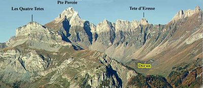
@rSiffointe  Geology
Aravis mountain range
TThe Aravis mountain range looks like an imposing wall of limestone (it peaks at 2752 m at the Pointe Percée), a veritable mineral monolith defined by a very uniform pattern of glacial cirques. It is composed of several sets of rocks formed in an ancient seabed. Due to Alpine tectonic compression, the mountains were split apart by several faults, compressing one on top of the other to create several groups of cliffs separated by overlaps.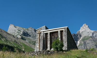
@veroniqueLORENZI 
The Doran chapel
The Doran chapel “Notre Dame of World Peace" was built by the scouts between 1951 and 1956 at an altitude of 1600m for herdsmen who lived up there all summer and had no other place to worship. It is located at the entrance to a natural cirque formed by the mountain pastures, bordered by the Barrière des Saix to the left, the Pointe d'Areu (2478 m) to the right and the Pointe Percée (2750 m), the highest peak in the Aravis, in the centre. The local flora is very rich and diverse. The Doran refuge, built in 1974, is open from June to October. https://refugededoran.fr/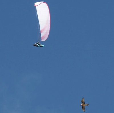
 Fauna
FaunaParagliding and wildlife
For the vast majority of land animals, paragliders are seen as very large predators, causing them to panic and flee. Such frantic escape causes major stress, which can lead to abortions in the mothers, loss of young chicks, injury or death. Fellow pilots, please be vigilant and respectful so that the bearded vulture, golden eagle, Alpine ibex and other wildlife in the mountains can continue to reach soaring heights in peace. For more information, click here: "https://www.gypaete-barbu.com/10/le-projet-life-gyphelp/64/on-a-fait-quoi-what-was-done/71/derangementsdisturbance.html"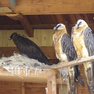
@Asters  Fauna
FaunaBearded vulture reintroduction programme
Asters is home to France's only Bearded Vulture breeding centre, providing space for 4 pairs. The aim is to produce chicks for the various reintroduction programmes. In order to ensure as much peace and quiet as possible, the centre is not open to the public, and work with the birds is kept to a minimum so that they behave in as natural a way as possible. The birds are fed daily with meat and bones from slaughterhouses and pet farms. For more information, click here "https://www.gypaete-barbu.com/4/le-centre-d-elevage/15/le-centre-de-haute-savoie
Description
Follow the signposted way to Doran (via sentier du Gypaète). At the first crossroads, turn right towards the village of Outredière. Just before you turn left, take a look at the Pierre à Voix in the distance. Keep to the left and head in the same direction: Doran. On your way up the forest path, take a look at the view of the Arve valley and the Mont-Blanc massif in the background. As you approach the Prés d'Outredière chalets, turn left at field edge. A short crossing on the mountainside takes you over the Dière torrent (water capture). Please note that this bridge is dismantled in winter, so follow the signs for "open or closed" at the path's start. After the footbridge, the path rise to the right via a few wooden steps, reaching the Doran valley and its chalets. The way back is a loop, recommended for a less steep descent. From the Doran chalets, descend following Plan Chevallier (on the driveway) and the Les Planes hamlets. After a long way downhill on this 4x4 track, turn left almost at the end of the forest, towards Plan Chevallier and Outredière.
- Departure : Plan Chevallier
- Arrival : Plan Chevallier
- Towns crossed : Sallanches
Altimetric profile
Recommandations
Please note that the Diére footbridge is closed during the winter season (October to May, depending on the weather conditions)! Follow the yellow signposts to see which trails are open and which are closed! For more information, contact the tourist office on 04 50 58 04 25! To help birds of prey and the Bearded Vulture in particular to peacefully co-exist with you, please behave responsibly when paragliding. https://www.youtube.com/embed/Kxbn_wHcS30
Transport
Transport on demand : https://www.montenbus.fr/
Access and parking
Departure point: Plan Chevalier car park, route d'Outredière 74700 Sallanches. From Sallanches, take the Route de la Provence towards Outredière.
Parking :
Plan chevallier parking area
Report a problem or an error
If you have found an error on this page or if you have noticed any problems during your hike, please report them to us here:
