
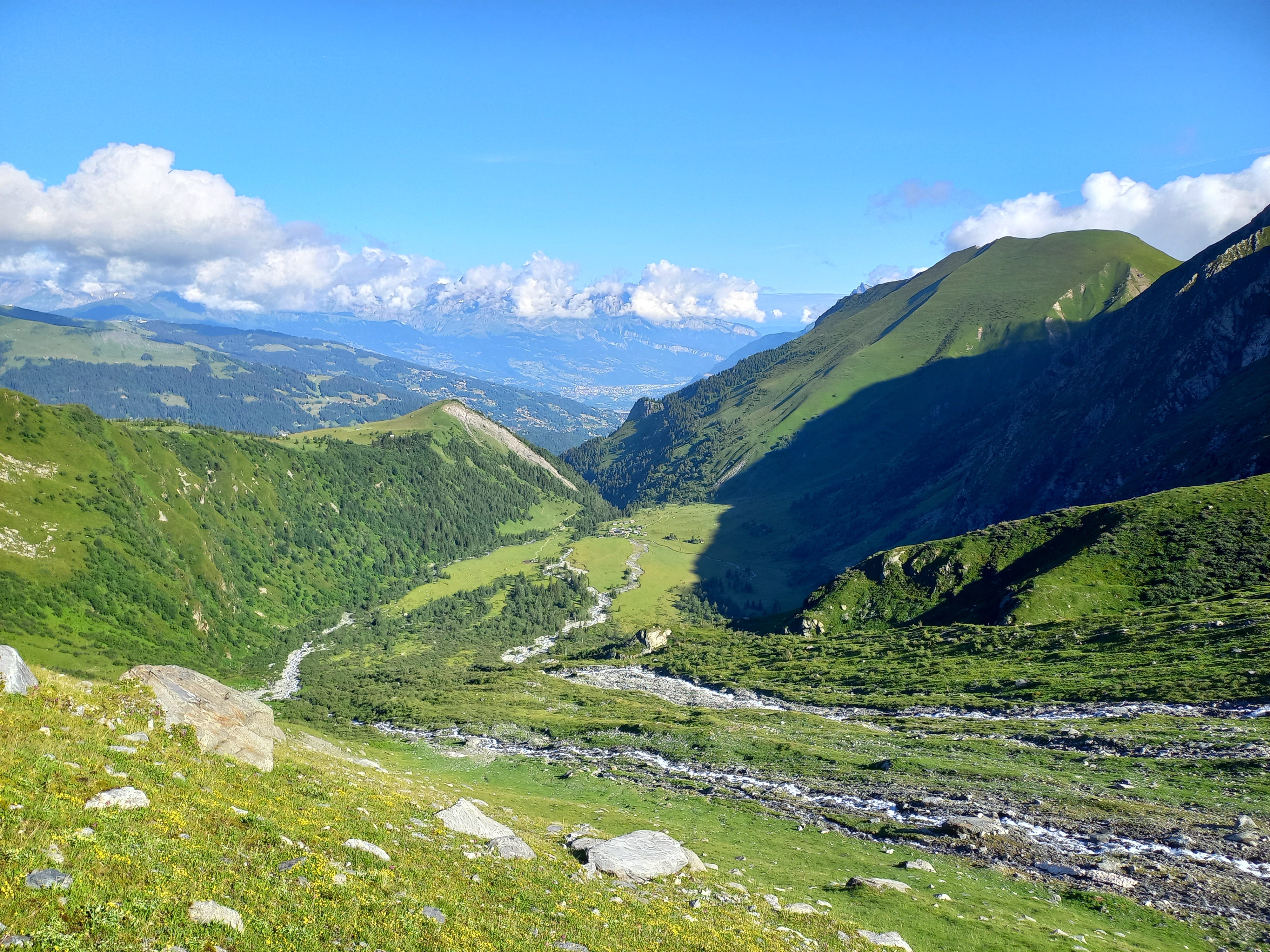
Going to Chalet de Miage via la Gruvaz
Saint-Gervais-les-Bains
Going to Chalet de Miage via la Gruvaz
Medium
4h
8,9km
+683m
-680m
Embed this item to access it offline
Discover the Miage glacier, sentinel of the climate, on an exciting hike in the heart of nature close to the local fauna.
Attachment
- Downloadpdf
Chalet-de-Miage-par-la-Gruvaz
Credit: Points d'intérêts du parcours
4 points of interest
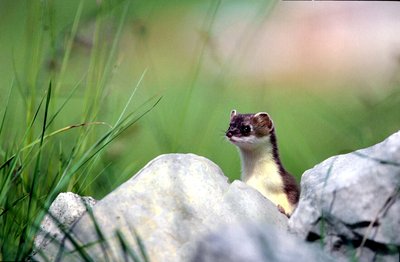
Hermine en été - @julienheuret  Fauna
FaunaThe Stoat or Short-tailed Weasel
A rocket-like appearance... White in winter with a brown back or a beige belly in summer, with a black tail tip all year round... Can you guess who's playing hide and seek in the scree? It's the Stoat, a small, fast and powerful mustelid, a member of the Badger and Marten family. It doesn't actually play, but rather hunts voles, its favourite prey, thanks to its elongated shape, which allows it to slip into their burrows, where they think they're well protected...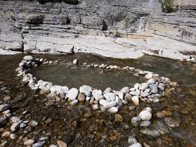
 Lake
LakeNegative impact of artificial dams on rivers
Occasionally, hikers and families may build a temporary dam just for fun. By creating artificial dams, they slow down the natural flow of the river and cause harmful effects: - The movement of aquatic species is essential to enable them to feed and reproduce. - The temperature of the water rises, silt and algae thrive and it becomes more difficult for fish to breathe. - Stones are refuges and habitats for many of the micro-organisms that feed fish. Moving or turning stones upside down endangers the aquatic environment. To protect the river, we must let it flow freely.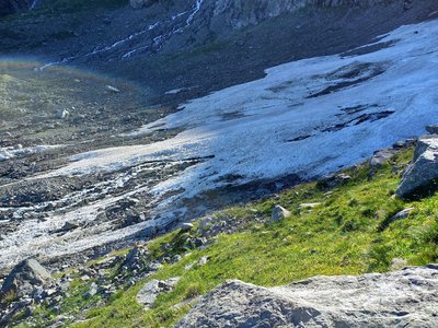
@KenzoHeas 
Miage Glacier retreat
In addition to their role as climate change indicators, glaciers are extremely important ecosystems on Earth. They cover almost 10% of the world's landmass and provide crucial ecosystem functions for humans and nature, such as sea-level regulation, climate and they also provide freshwater for the continents. Over the years, the Miage Glacier has undergone a major retreat. In just 150 years, it has retreated by around 1.5 kilometres since it was first stretched to the Grand Pont bridge in 1850. The Grand Pont bridge can be seen on the way up the stream to the Miage pastures. To find out more, visit the Ice Life project website, run by Asters-CEN74: https://www.iceandlife.com/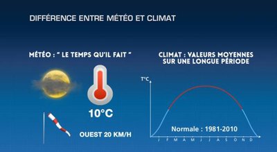
©LaChaîneMétéo 
Weather vs Climate
Weather forecast is the assessment of what the weather will be like over a short period of time. Forecasts are made on the basis of fluid mechanics, combining factors such as air, wind and water... Climate is the study of meteorological variables over a long period of time (30 years by convention). Several parameters distinguish weather from climate: - The time scale: weather forecasts are made over a week, whereas climate trends are thought out over a decade or even a century. - The geographical scale: weather forecasts are local, whereas climate forecasts look at trends over an entire region, or even the planet. In short: weather forecasts look at day-to-day fluctuations, whereas climate forecasts look at all these fluctuations over a long period of time. Here’s a fun hint: You've been a calm, reserved person for 30 years (climate) and you get all worked up for 72 hours (weather)!
Description
From the centre of Saint-Gervais, the shuttle bus takes you to the hike’s starting point in less than 20 minutes. After crossing the Miage stream, go uphill on the marked trail to Maison Neuve. Turn right towards Chalets de Truc. Once you reach them, just below the chalets, you'll find an orientation map showing the stunning panorama of the Miage domes and their glaciers, the Aiguille de Bionnassay, the Aiguille de la Bérangère and the Col du Tricot. The descent to the Miage mountain pasture is down a steep trail that offers breathtaking views of the stream and the Miage chalets. In front of you is the Col du Tricot with its highest point at 2120 m. Return via the wide country road to the Gruvaz parking area.
- Departure : Saint-Gervais, Le Bettex cable car
- Arrival : Saint-Gervais, Télécabine (Cable car) Le Bettex
- Towns crossed : Saint-Gervais-les-Bains and Les Contamines-Montjoie
Altimetric profile
Sensitive areas
Along your trek, you will go through sensitive areas related to the presence of a specific species or environment. In these areas, an appropriate behaviour allows to contribute to their preservation. For detailed information, specific forms are accessible for each area.
- Impacted practices:
- Aerial, , Land, Vertical
- Contact:
- Asters - Conservatoire d'espaces naturels de Haute-Savoie
contact@cen-haute-savoie.org
Black grouse - winter
- Impacted practices:
- , Land
- Sensitivity periods:
- JanFebMarAprDec
- Contact:
- Asters - Conservatoire d'espaces naturels de Haute Savoie
Christelle BAKHACHE : 06 49 99 99 48
christelle.bakhache@cen-haute-savoie.org
Recommandations
Always be careful and plan ahead when hiking. Asters, CEN 74 can not be held responsible for the occurrence of any accident or incident on this trail.
Transport
Timetable of the bus departing from the cable car parking area, Saint-Gervais-les-Bains centre.
Access and parking
The Gruvaz car park has very little space. We advise you to take the bus from Saint-Gervais centre.
Parking :
Saint-Gervais Télécabine (Cable car) : 201 Av. du Mont d'Arbois, 74170 Saint-Gervais-les-Bains
Report a problem or an error
If you have found an error on this page or if you have noticed any problems during your hike, please report them to us here: