
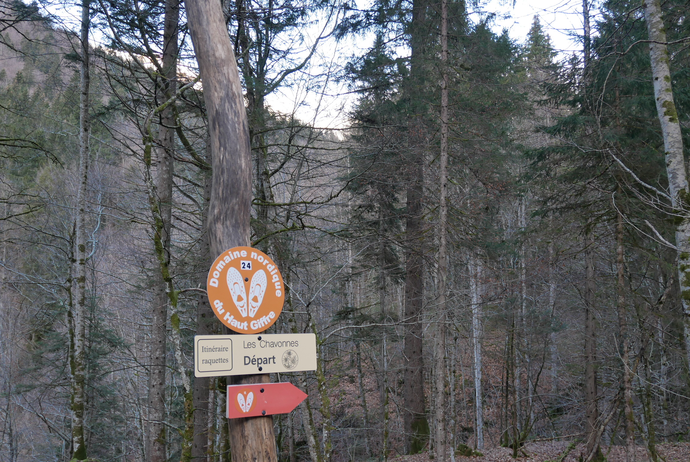
Getting to Les Chavonnes via the Crêt de Vosy : snowshoeing in Samoëns
Samoëns
Getting to Les Chavonnes via the Crêt de Vosy : snowshoeing in Samoëns
Medium
1h30
4km
+263m
-260m
Embed this item to access it offline
A trail filled with fascinating passerine bird facts and stories about Samoëns' heritage
4 points of interest

Magnétoreception - @KyleBean  Fauna
FaunaBird migration: how do birds navigate themselves in flight?
Migrating birds are sensitive to the Earth's magnetic field, that is aiding their navigation on long journeys towards their breeding and overwintering grounds. Magnetoreception is one of the many mechanisms that migratory birds use to navigate. They often combine this ability with other cues, such as stars, sun, gravitational field and visual cues. These incredible abilities of birds are being affected by urban/agricultural development. City lights confuse birds during nighttime. On top of this, the proliferation of large-scale farming and climate change are shifting the migratory patterns of certain species and endangering them on their journeys. According to the International Union for Conservation of Nature, one third of all nesting birds in mainland France are now at risk of extinction. The Col de Golèse, visible from this meadow, is an important migratory route.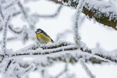
Passereaux en hiver : Mésange bleue - @Asters-CEN74 FaunaA “circle dance” of passerines in winter
You can often hear noisy flocks of forest passerines led by tits. This typically reclusive family of birds includes Eurasian nuthatch, various creepers, crested tits, marsh tits, Eurasian blue tits and great tits…. Many of them flock together, sometimes along with other species, forage for food and snuggle up to each other to retain their warmth. These flocks also reduce the need for constant lookout for predators. Most of these birds stay active during winter and feed on nuts, dried fruit, seeds, twigs and branches. The only exception is the robin, which doesn't participate in winter flock life.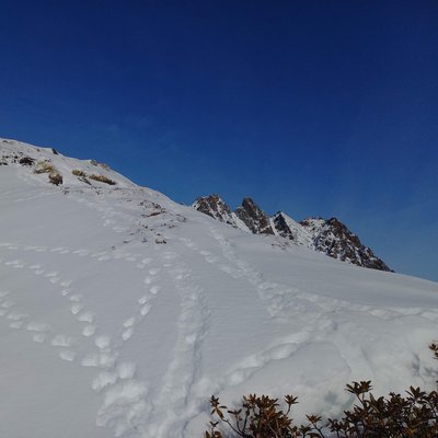
traces-hiver-Lagopéde - @julietteBuret FaunaCoping with winter
Winter is a harsh time of year for most species, so everyone has their own strategy for staying alive during these long months. While the ground is an excellent shelter for small invertebrates, it can also be a shelter for larger animals such as snakes, which hide under large stones, or tortoises that burrow themselves into the ground... Marmots do the same, sealing up their burrows before going into hibernation. Other animals who remain active for only a few hours during the day can use the snow to insulate themselves from the cold, for example black grouse. Just be careful not to trample on their shelters!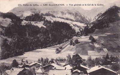
Village des Allamands - @Hierasamoens 
Les Allamands village
The village owes its origins and its name to a tribe of Germanic origin known as the ‘Hans’, who settled in the Val Clévieux around the year 1206. Their village was devastated in the 15th century by a landslide that came from the Pointe de Chamossière. Because of their Germanic origins, they gave the name ‘Allamands’ to the site they settled on. The Allamands village, at the foot of the Col de la Golèse and the Col de Bostan used to be very busy. The Col de la Golèse was part of the ‘route du Valais’ which, after crossing the Col de Coux, led down into Swiss territory and on to the main Rhone Valley route. The village was also a meeting point for contraband smugglers and other illegal immigrants. Back in the day, they would bypass the Col de la Golèse, which was guarded by men-at-arms, via a steep path known as ‘le pas de la Bide’, which led to the Col de Bostan before reaching the village.
Description
Opposite the Crêt parking area (located above the Pied du Crêt Parking) Start out on a wide path bypassing the village of Les Allamands on the left. The path leads through a beautiful mixed forest and then alongside a large meadow, a summer grazing area, with a view of the village of Les Allamands and the rounded hilltop of the Tuet Mountain. Below, the mountain stream flowing from the Creux de Chamossière charges the area with its energy. After an initial gentle slope, the route forks left to reach the Crêt Vozy farm and then climbs a narrow path through a forest where you can see how beech and spruce compete for space among other various mountain tree species. After a steep but fairly short climb, the route joins the wide path coming from the Plan aux Arches and leading to the Col de la Golèse. By turning left, you can easily reach the Chavonnes farm, the highest point of the hike, from where you can enjoy views of the slopes of the Golèse mountain and the Criou cliffs. Starting from this spot, there is a high risk of avalanches. The return descent takes the same route as far as the Crêt Vozy fork. From here, leave the Crêt Vozy path to the right and descend the forest track to the Plan aux Arches parking. Opposite the car park, the route takes a fairly wide path that avoids the road leading to Allamands. After two hairpin bends and a gentle descent, you will reach the road, the village of Allamands and finally the Crêt parking.
- Departure : Du Crêt' parking area
- Arrival : Du Crêt' parking area
- Towns crossed : Samoëns
Altimetric profile
Recommandations
Always be careful and plan ahead when hiking. Asters CEN-74 cannot be held responsible for any accident or inconvenience that may occur on this trail.
Access and parking
Parking :
Du Crêt' parking area
Report a problem or an error
If you have found an error on this page or if you have noticed any problems during your hike, please report them to us here: