Pic de Marcelly
Taninges
Pic de Marcelly
Medium
3h30
8km
+602m
-599m
Embed this item to access it offline
Discover mountain lakes, alpine flowers and learn how to protect birdlife
4 points of interest

Dispositif Birdski - @IlkaChamply  Fauna
FaunaBird protection: high visibility overhead cables
To reduce the risk of mountain birds colliding with overhead cables, it is essential to increase their visibility. As part of the Birdski project, Asters-CEN74 and other partners are proposing several high visibility kits that can be adapted to each type of equipment. You can see them here. This project is contributing to greater awareness of the presence of mountain birds in ski areas in order to limit the mortality of these species (Black Grouse, Bearded Vulture, etc.) and improve ecological interconnectivity. If you heard a particularly captivating birdsong during your hikes and liked it, you can download the Birdnet app on your smartphone that can help you identify the performing bird!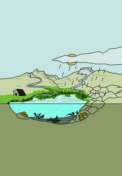
Lacs sentinelles - @ClotildeRémusat  Lake
LakeMountain lakes and the impact of human activities
The impact of human activities on the banks of high-altitude lakes depends on the extent of such activities. Water abstraction and/or the production of hydroelectric power require the lakes to be landscaped. This impacts not only the topography but also the hydrology. In addition, the presence of mountain huts or herds on the banks of a high-altitude lake can generate or accelerate nutrient enrichment. If these nutrients are concentrated in the water at too high a level, they can enrich the lake and lead to an overproduction of biomass. This can lead to eutrophication and eventually result in hypoxia of the lake waters. It is essential to monitor such pollution to ensure that the lake remains in a healthy condition. We can then adjust and adapt our behaviour to harmonise the environment and human activities. Help to keep the lake running smoothly by respecting the swimming and fishing regulations. To find out more about mountain lakes, visit our dedicated website https://www.lacs-sentinelles.org/.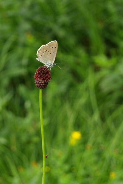
@mariondegroot  Fauna
FaunaScarce large blue
This butterfly found in wet meadows, it boasts a unique genetic make-up and is one of the only species in France with partially carnivorous caterpillars. Butterfly caterpillars are 99.9% phytophagous, meaning they feed on plants. Maculinea caterpillars, from the 4th instar onwards, change their feeding habits to feed on the larvae of a particular type of ant: the Myrmica. After feeding on Sanguisorba seeds, the caterpillar must be picked up by these specific ants. By imitating the smell of ant larvae, the caterpillar is carried away and housed and fed in the anthill all winter by these red ants. The development and survival of these two butterfly species therefore depend on the presence of Sanguisorbe (a plant that fears competition from tall weeds) and favourable environmental conditions for the host ant species.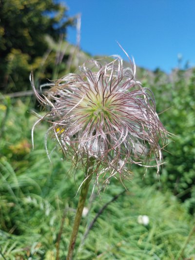
Anémone des Alpes - @julietteBuret  Flora
FloraPulsatilla alpina
Alpine Anemone grows at altitudes of between 1,000 and 2,750 m in the mountainous regions of central, western and southern Europe (Alps, Vosges, Auvergne, Pyrenees, Apennines, etc.). Its white or yellow flowers, which measure around 5 cm in width and vary depending on the subspecies and the acidity of the soil, appear fairly early in the season, from May to July. The fruits are very long, feathery achenes, enabling the plant seeds to be disseminated by the wind. The name pulsatilla comes from the Latin ‘pulsatilla’, derived from ‘pulsatus’, which means ‘battered by the wind’. This plant is inedible for humans and domestic animals.
Description
The Molliettes parking area- Praz-de-Lys
Take the path on the left before the bend and follow the signs for ‘Pic de Marcelly’ and ‘Lac de Roy’ (30 min). The climb is steep, and you will soon reach the lake (follow the path on the left, the path on the right towards the Col de la Ramaz makes a diversion via the Chalets de Véran).
Upon arrival at the lake, go around it to the left and head for ‘Chalet de Roy’ and ‘Pic de Marcelly par Gron’ (1h15min), always keeping to the left.
After Chalet de Roy, the path descends slightly for around 100 metres.
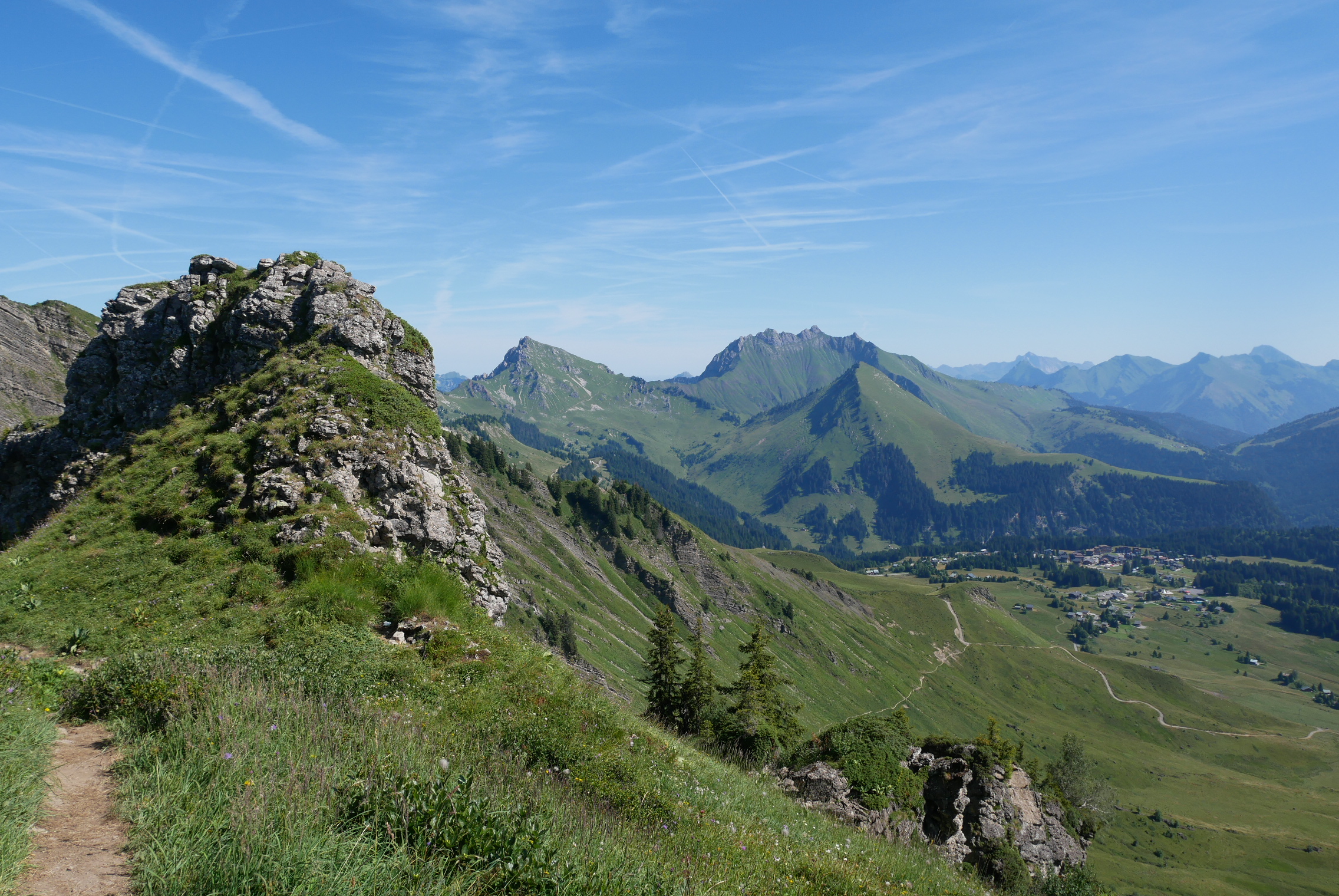
At the first bend in the path, fork right towards the Pic de Marcelly, where you'll be able to see a religious cross at the summit. A pretty view opens up behind you: Roc d'Enfer, Pointe d'Uble and Mont Chéry.
When you reach the ridge, follow the path to the right and walk (under the peak of Marcelly) towards the summit.
Then, turn right for slightly more difficult, steep climb.
Return down the same path following Praz-de-Lys (Les Moliettes).
- Departure : Praz-de-Lys
- Arrival : Praz-de-Lys
- Towns crossed : Taninges
Altimetric profile
Recommandations
Always be careful and plan ahead when hiking. Asters CEN-74 cannot be held responsible for any accident or inconvenience that may occur on this route. Check the weather conditions before setting off. Mountain Rescue contact details: call 112 Frête de Penaille and Pas de l'âne are tricky sections best avoided. The final climb to the Pic de Marcelly is difficult. Respect the work of farmers, managers and owners Close all fences Bring back all rubbish Do not take shortcuts through meadows
Access and parking
Parking :
Molliettes Parking area
Report a problem or an error
If you have found an error on this page or if you have noticed any problems during your hike, please report them to us here:
