
Reaching The Mont Joly from Le Baptieu
Les Contamines-Montjoie
Reaching The Mont Joly from Le Baptieu
Hard
6h
15,9km
+1327m
-1327m
Embed this item to access it offline
This itinerary reveals in detail the geology of the massif, its boundaries and natural drainage system.
4 points of interest
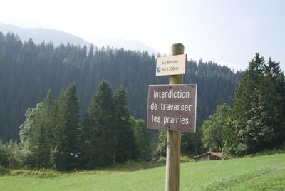
Panneau interdiction - @julietteBuret  Geology
Staying on the beaten track to avoid damaging the environment
The urge for greater freedom sometimes leads to the desire to get off the beaten track. Many people want to make their own tracks without following the trail. Unfortunately, repeated off-trail hiking quickly damages the soil and vegetation. This results in soil erosion and the loss of grassland needed to feed the herds. Let's preserve the environment that we all love and protect the species that live here by staying on trails. Have a look at our restoration work in the Nature Reserve.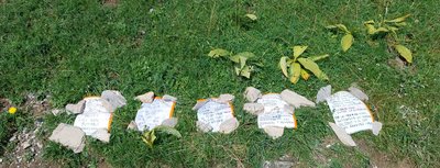
Panneaux bergers - @julietteBuret 
What are fences used for?
During your field trips, you're bound to come across pasture fencing. Their installation is a tedious (and sometimes dangerous) task that helps to manage the pasture. On the one hand, they prevent the herds from getting lost in the mountains and protect them from predators, and on the other hand, they help to organise herd feeding. Unfortunately, a lot of fences are damaged by careless use, leaving an entry point for predators and a possible escape route for some of the livestock. Several types of fences (movable or stationary) are installed with several different crossing points. Cross the fences at the crossing points only. For your own safety and that of the animals, be careful to close the gates behind you when necessary.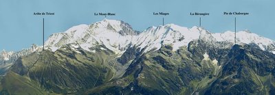
Toponymie massif du Mont-Blanc - @reneSiffointe GeologyToponymy: history of landscape
The Alps were formed when the African plate, particularly part of it which is now modern day Italy, drifted towards the European plate, creating a chain of mountain ranges from northern Italy to Vienna. Rivers, glaciers and gravity carved out this landscape. Arctic steppes and forests sprang up, mammoths had gone extinct and modern fauna settled in. The first humans arrived in Val Montjoie 10,000 years ago, settled down and changed the landscape over the last 3,000 years. The Little Ice Age (1300-1850) led to a period of cold, before modern global warming rapidly transformed the landscape. At the next stop with informational signs, you will learn of all the names of Mont Blanc massif’s peaks and understand how they were formed.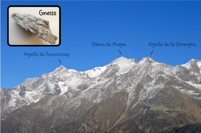
Géologie : Le gneiss - @NRG GeologyGneiss
The underlying geology of this landscape is mainly composed of gneiss. Unlike the granite rocks of the north-east of the Mont-Blanc massif which form large, tapering needles, the rounded gneiss peaks make up the entire south-west of the massif (including the summit of Mont-Blanc). These rocks resemble thin sheets of paper (“millefeuille”): some of the minerals of which they are composed have been crushed and rearranged by underground pressure. They are the product of the recrystallisation and deformation of ancient rocks at depth, under very high pressure and temperature conditions.
Description
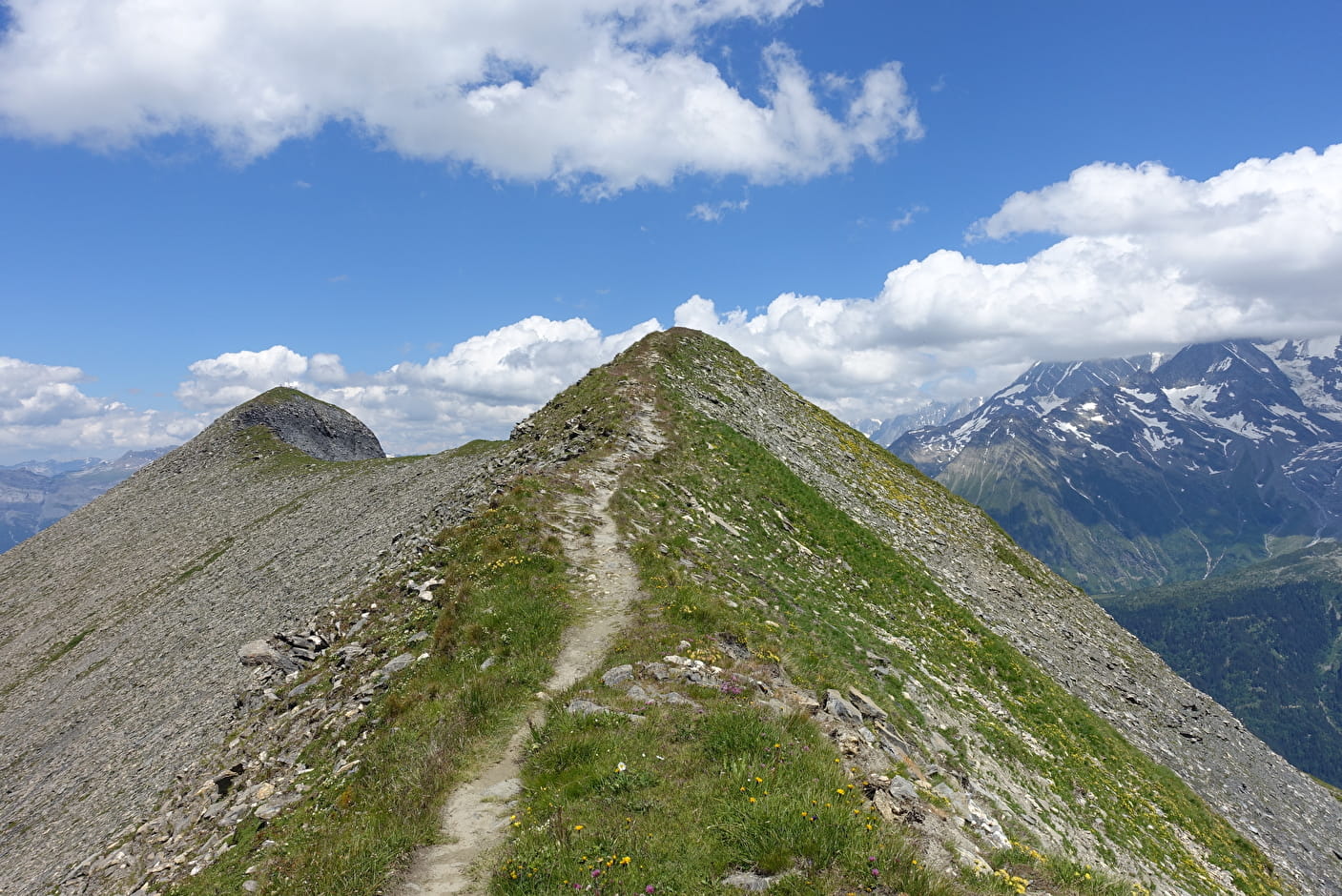
From'Le Baptieu' parking area Pass through the hamlet, walking past the chapel and start climbing towards Colombaz using either the footpath in the forest or the dirt road. After an hour's walk, you'll reach the Colombaz Auberge (inn) and chalets. To climb the Mont Joly, leave the road after the Auberge de Colombaz and take the path up the steep slope towards the Tête de la Combaz, always keeping to your right. Turn right at the fork one last time and follow a vertiginously high ridge to the Mont Joly, at 2525 m altitude. Return by the same route.
- Departure : Le Baptieu' parking area
- Arrival : Le Baptieu' parking area
- Towns crossed : Les Contamines-Montjoie and Saint-Gervais-les-Bains
Altimetric profile
Recommandations
Always be careful and plan ahead when hiking. Asters CEN-74 cannot be held responsible for any accident or inconvenience that may occur on this trail.
Access and parking
Parking :
Le Baptieu' parking area
Report a problem or an error
If you have found an error on this page or if you have noticed any problems during your hike, please report them to us here: