Le Dérochoir from Plaine-Joux
Passy
Le Dérochoir from Plaine-Joux
Very hard
4h
11,7km
+972m
-972m
Embed this item to access it offline
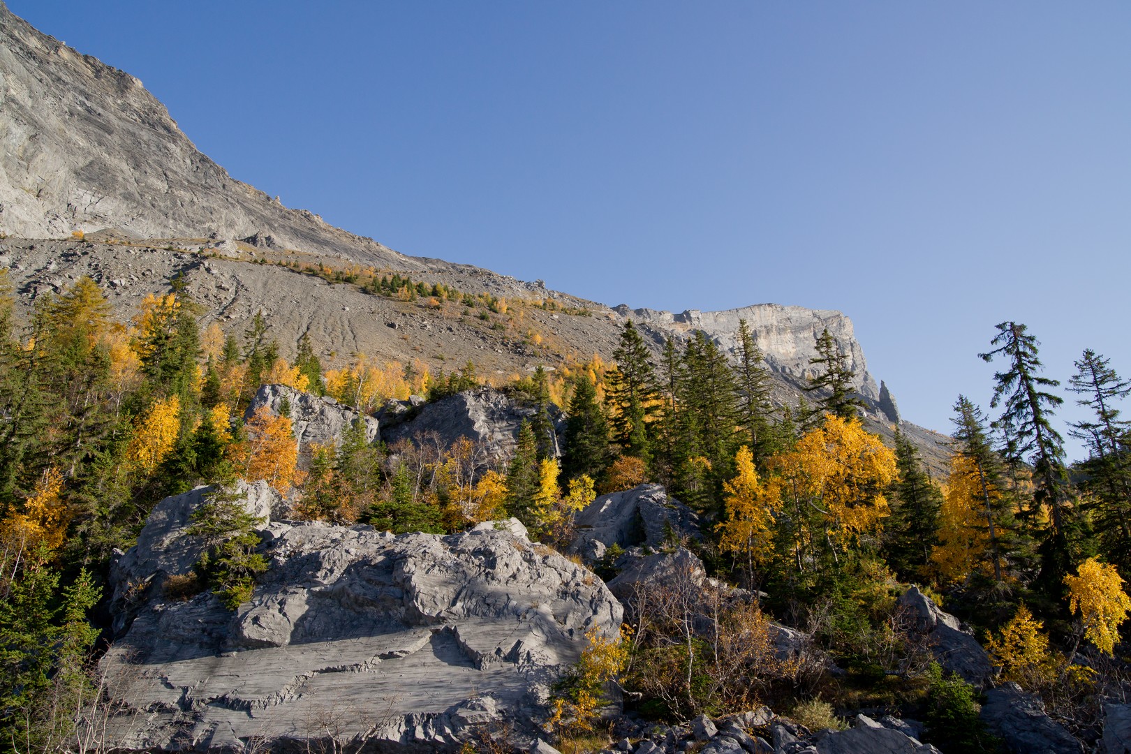
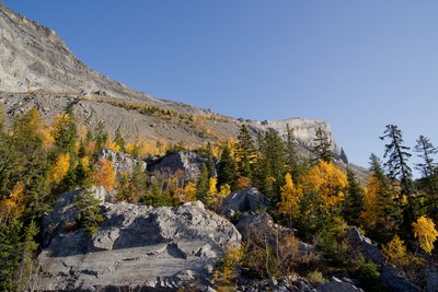
You will conclude your hike by ascending and descending the Passage du Dérochoir. Walk through this immense rocky scree, initially along the trail and then through a chaotic mass of rocks. Some passages require you to climb slabs. There are chains, ropes and stairs to help you on your way up. But be careful! This is a difficult and hair-raising route, suitable only for experienced hikers. The approach to the Désert de Platé via the Dérochoir pass is absolutely breathtaking. The views are astounding; the green colors of Vallée de l’Arve and Mont-Blanc on one side, and a rocky landscape on the other.
Attachment
- Downloadpdf
le-derochoir-depuis-plaine-joux.
Credit: Points d'intérêts du parcours - Asters-CEN74
14 points of interest
Le Dérochoir à l'automne - Julien Heuret - CEN 74 
Overlooking the Dérochoir
The Dérochoir is the product of a series of landslides. The first known and documented landslide dates back to 1471. The second and last, for the time being, was in 1751. At the foot of the cliff is a huge landslide cone that forms an unsteady slope. These landslides made it possible to cross the Barre des Fiz.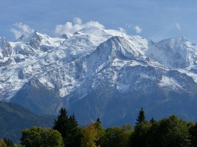
Panorama sur le Mont-Blanc depuis Plaine-Joux - Lucie Rousselot - CEN 74  Peak
PeakThe mont Blanc before the rise of mountaineering
A lot of mountaineers have dreamt of climbing Mont Blanc, the highest peak in Western Europe. But this has not always been the case. In the past, the mountains instilled fear and superstition in their local inhabitants, as evidenced by the names given to the summits ("cursed mountain", "devil's spikes"...). Only shepherds, chamois hunters and stonemasons (extractors of rock crystals) frequented these hostile areas. The first ascents were made by daring foreigners who hired these experienced mountaineers to provide guidance.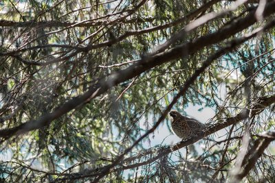
Gélinotte des bois - Julien Heuret - CEN 74  Fauna
FaunaThe Hazel Grouse
This is the smallest and most elusive of the mountain Galliformes species. It is much less well known than the black grouse or the rock ptarmigan because it lives exclusively in the forest! But it is just as important from a biological and scientific point of view: this species is an excellent indicator of environmental change. Its specific requirements in terms of vegetation and variety of tree species put it at risk in the face of poor forest management. This is one of the main causes of the species' decline.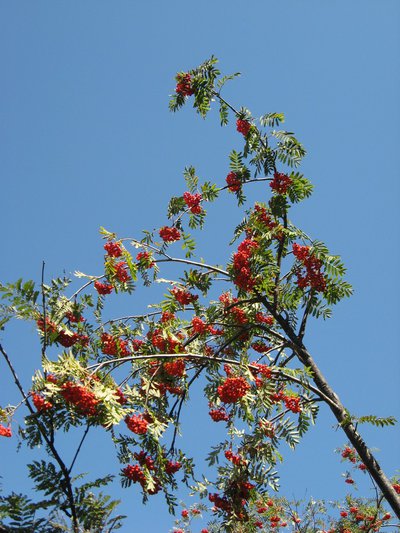
Sorbes - Julien Heuret - CEN 74  Flora
FloraThe Mountain Ash
It is a small tree that grows on the edge of forests. Its fruit, called "sorbs", are orangey red berries that are very popular with thrushes and blackbirds. They can be used to make brandy, jelly, or jam. Just make sure you pick them before they are ripe, otherwise, they may become toxic! In the reserve, the mountain ash is being studied as part of a collaborative science programme designed to measure the impact of climate change in the mountains.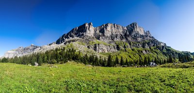
Les Fiz depuis les Ayères - Julien Heuret - CEN 74 The 'Ayères'
The word "Ahier" originally comes from the Roman dialect for sycamore maple. The terms "pierrières" and "roc" come from the many boulders that formed during the rockslides at Dérochoir, including the one in 1751 that killed 6 people and a few domestic animals. All these cottages were mountain chalets used for farming. Now they are used as vacation homes.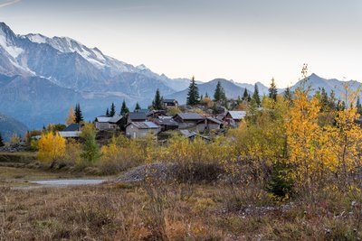
Chalets d'Ayères à l'automne - Julien Heuret - CEN 74 
The alpine cabin
The alpine cabine is a small building which, gattered with others, forms a small hamlet.
These constructions were originally intended for the organization of agricultural life in the mountains. These cabins were used in the summer to shelter the shepherds and their family. They were also used for milking and the production of cheese and other dairy products.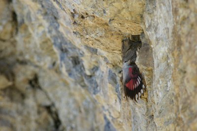
Tichodrome échelette - Julien Heuret - CEN 74 FaunaThe Wallcreeper
This is a bird associated with the steepest cliff slopes! It is found mainly in the mountains, from the Alps, all the way to the Himalayas. Cold snowy winters, however, can force it to migrate to stone buildings in the city centres! This skilful climber, with its long curved beak and talon claws, hunts down insects concealed in the most remote rock crevices. It is difficult to observe, unless you your eye catches it mid-flight. Its butterfly-like undulating circular movements with shimmering colours of grey, red and black are hard to miss!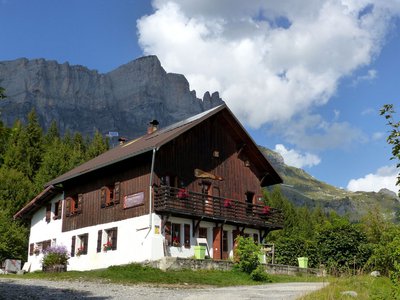
Refuge le Châtelet d'Ayères - Lucie Rousselot - CEN 74  Refuge
The mountain refuge of Châtelet d'Ayères
Charming Châtelet d'Ayères mountain refuge lies nestled in a picturesque landscape with breathtaking views over Mont Blanc. Built 100 years ago and now run by a local family from Passy, it was home to some of the great names in mountaineering in the 1950s, including Roger Frison-Roche and Maurice Herzog. Its renowned cuisine attracts gourmets who enjoy the taste blueberry tart and the famous "farcement", a cult local delicacy. The restaurant is entirely solar-powered. Enjoy in moderation!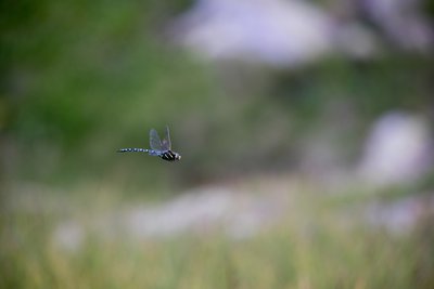
Julien Heuret - CEN 74 FaunaDragonflies
Odonates, more commonly known as dragonflies, belong to the insect family. They undergo two stages in their lives: a "larval" phase, which is aquatic, followed by a terrestrial phase, which marks adulthood. Dragonflies are predators: they are carnivores, feeding on different types of prey depending on their life stage. They also prey on other insects. Their habitat is strongly influenced by climatic conditions, and any change will have a major impact on their numbers. The destruction of their habitat, wetlands, is one of the main threats to dragonflies.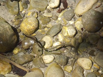
@NicolasPerrouchet FaunaThe Grass Snake
A semi-aquatic species, it is found mainly in wetlands, but also in drier areas where it is able to prey on amphibians (frogs, toads, salamanders and newts). Like all reptiles, it is a protected species! It can be recognised by its round pupils, its olive-grey skin and its double black and white or yellow neck. Its other distinctive feature: when it feels to be in danger, it spits out a foul-smelling liquid and then plays dead, revealing its two-coloured belly in the pattern of a piano keyboard!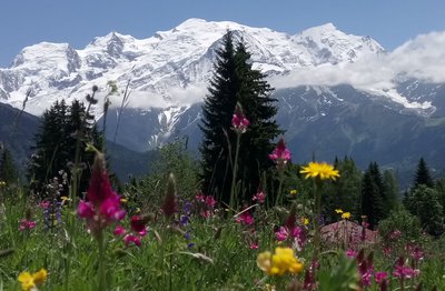
Le Mont-Blanc depuis une prairie fleurie de Plaine-Joux - Lucie Rousselot - CEN 74 History of Plaine-Joux
From woodland to mountain pasture, Plaine-Joux has not always been a ski resort. Its very name, which means "forest on a flat landscape", bears witness to this. As early as the 1930s, the residents of Passy were enjoying skiing on this site blessed with an exceptional panoramic view. It was around 1965 that it officially became a municipal ski resort. Today, Plaine-Joux remains a popular family resort for skiing, hiking, paragliding... or just admiring the scenery.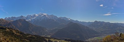
Panorama Mont Blanc - Julien Heuret - CEN 74  Geology
The mont Blanc
Under the snow and glaciers, two major rocks form the Mont-Blanc Massif: the sharp edges and highest peaks are made of very hard granite (from left to right: Chamonix Needles, including the Aiguille du Midi, Mont Blanc du Tacul, Mont Maudit, Mont Blanc summit), while the rounder, softer parts are made of gneiss (from left to right: Dôme du Goûter, Aiguille du Goûter, Aiguille de Bionnassay....). These two so-called crystalline rocks come from the Earth's molten core.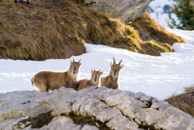
Bouquetins - Julien Heuret - CEN 74 FaunaAlpine ibex
The Alpine ibex is not particularly shy, especially compared with the chamois, with which it often shares its territory. Unlike most other mountain species, it remains at high altitudes even when winter and snow are approaching. It then heads for the ridges and snow-free areas where it can more easily find the grasses on which it feeds. This search for food takes a lot of energy. So, if you come across one, don't approach it and let it move away at its own pace so that it doesn't expend its energy unnecessarily, especially in winter.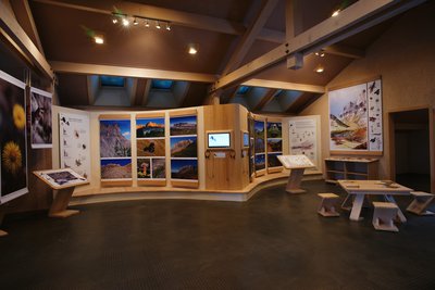
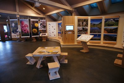
Muséographie Maison de la réserve - Julien Heuret - CEN 74 La Maison de la Réserve
The exhibition an information office Maison de la Réserve naturelle de Passy is located in Plaine-Joux and welcomes you during the school holidays. The permanent exhibition about fauna, flora and landscapes will open the doors to the nature reserve. You may find answers to some of your questions here and can admire the wild species hidden in nature. If the Maison de la Réserve Naturelle is closed, don’t worry, go up to the passageway. There is permanent free access to information about former (geological times) and present landscapes, the wonders of biodiversity, and the great challenges of the mountains of the future (water, glaciers, global warming...).
Description
Start from the Maison de la Réserve naturelle de Passy. Take the paved road that passes in front of the "Lou Pacheran" restaurant. Take the trail up towards the Col d'Anterne. Marker 102. At the signpost, continue on the trail towards the Col d'Anterne. Marker 103. Continue straight ahead on the trail towards Ayères des Pierrières, Col d'Anterne. Marker 16. Go through the village of Les Ayères des Pierrières. Marker 18. Take the path on the left, signposted Le Dérochoir. This is a difficult path. It is marked with red spots on the rocks. As you pass Le Dérochoir, take the opposite path. Marker 18. Head towards Plaine Joux and cross the hamlet of Ayères des Pierrières. Marker 16. Turn left towards Les Mollays. At the Châtelet refuge. Head towards Lac Vert - Plaine Joux. Marker 143. Take the trail down to the left. Head towards Lac Vert - Plaine Joux. Marker 95. Cross the Lac Vert car park and take the paved road towards Plaine Joux. Marker 159. Marker 93. Take the footpath on the left towards Plaine Joux. Turn left onto the paved road. Follow the signs for Plaine Joux.
- Departure : Maison de la Réserve naturelle de Passy
- Arrival : Maison de la Réserve naturelle de Passy
- Towns crossed : Passy and Sixt-Fer-à-Cheval
Altimetric profile
Sensitive areas
Along your trek, you will go through sensitive areas related to the presence of a specific species or environment. In these areas, an appropriate behaviour allows to contribute to their preservation. For detailed information, specific forms are accessible for each area.
- Impacted practices:
- Aerial, , Land, Vertical
- Contact:
- Asters - Conservatoire d'espaces naturels de Haute Savoie
contact@cen-haute-savoie.org
Recommandations
This itinerary runs through the nature reserve, please consult the relevant regulations. Difficult and high altitude passage, for experienced hikers. Bring plenty of water with you.
Transport
Bus SAT Mont-Blanc L85
Access and parking
Passy Plaine-Joux resort is accessed via the D43 road. Car parking is at the entrance to the resort. Bus line L85 (SAT Mont-Blanc).
Report a problem or an error
If you have found an error on this page or if you have noticed any problems during your hike, please report them to us here: